Text: Claire Lessiau & Marcella van Alphen
Photographs: Claire Lessiau & Marcella van Alphen
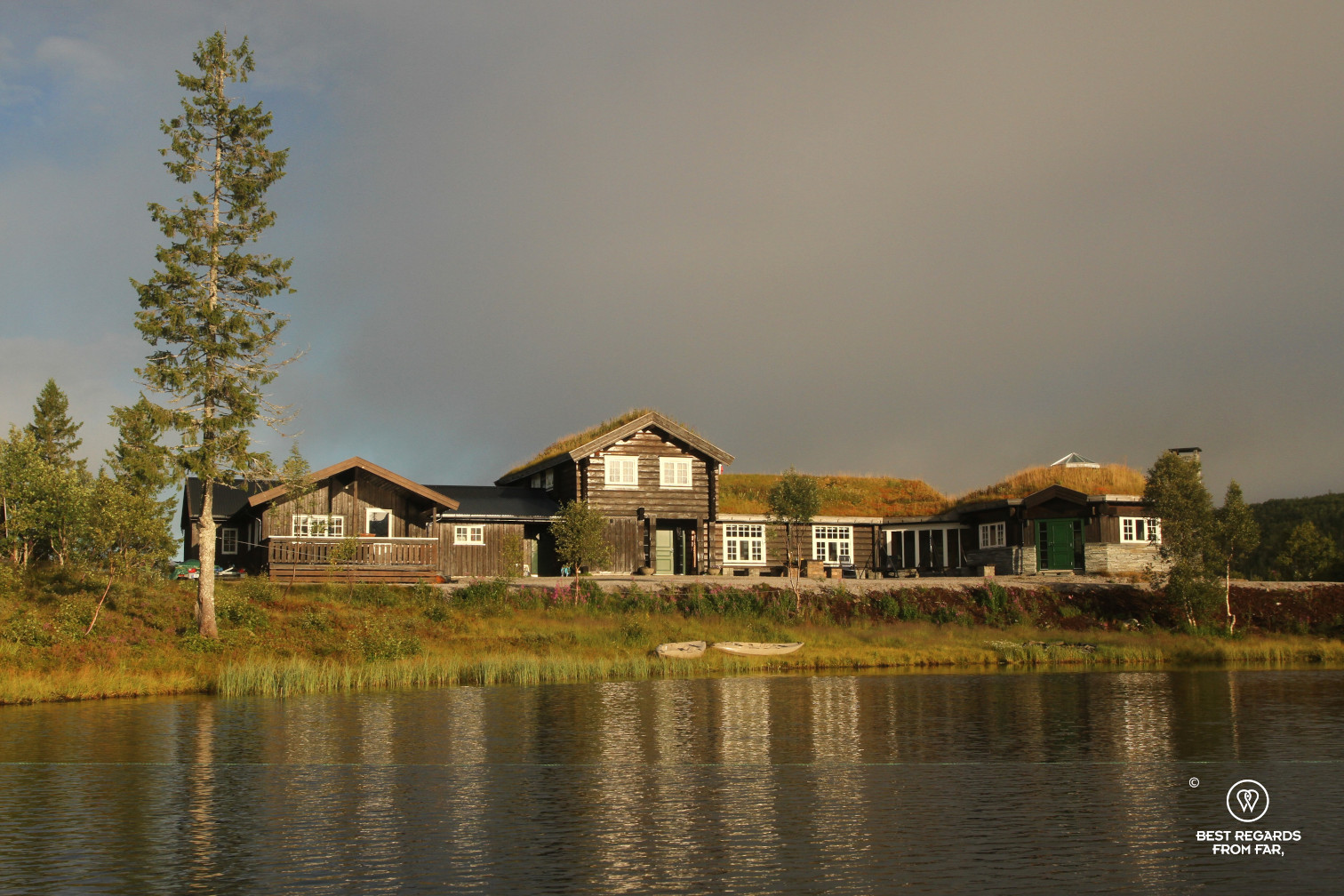
Above Snåsa in the heart of Mid-Norway, a winding dirt road takes us to Ismenningen Fjellstuggu at an altitude of about 500 meters. Our host, Skjalg Ledang welcomes us with a warm smile as we arrive. With his wife Grethe, he has recently acquired this former hunting chalet to turn it into a homey accommodation to explore the beautiful surrounding wilderness of the Blåfjella – Skjækerfjella / Låarte – Skæhkere National Parks, close to the Swedish border.
Pin it for later!
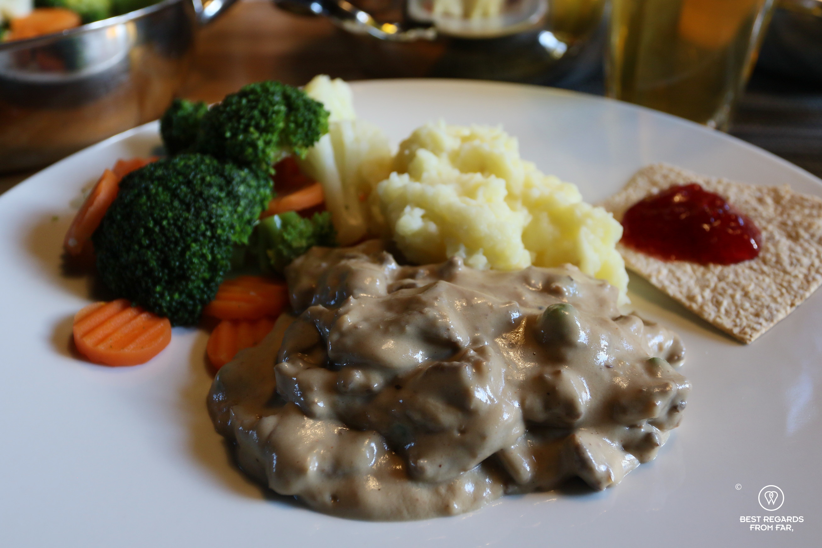
Skjalg grew up in the area, and he is passionate about his mountains. As we are sharing a delicious reindeer stew from his local Sami supplier in our wooden cabin, he tells us stories about a secret resistance hide where Major William Colby – later, head of the CIA – ran Operation Rype from, a plane wreck and the only shooting between Germans and Americans that happened in Norway during World War II… His eyes light up as he recalls his childhood memories about this fascinating place: “One day my father, uncle, cousin and I set out on an expedition through the valleys and mountains. It was 1975 and we slept out in the wild by the plane wreck after a full day hike. We attended a ceremony with guests who were helicoptered in. Amongst them was William Colby. We then visited the remote cabin where the resistance fighters used to operate from.”

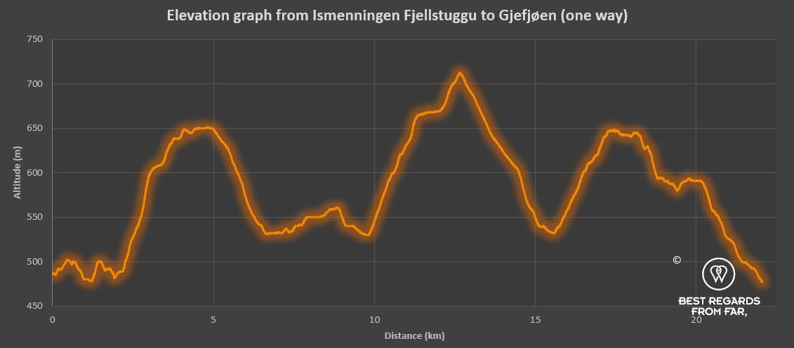
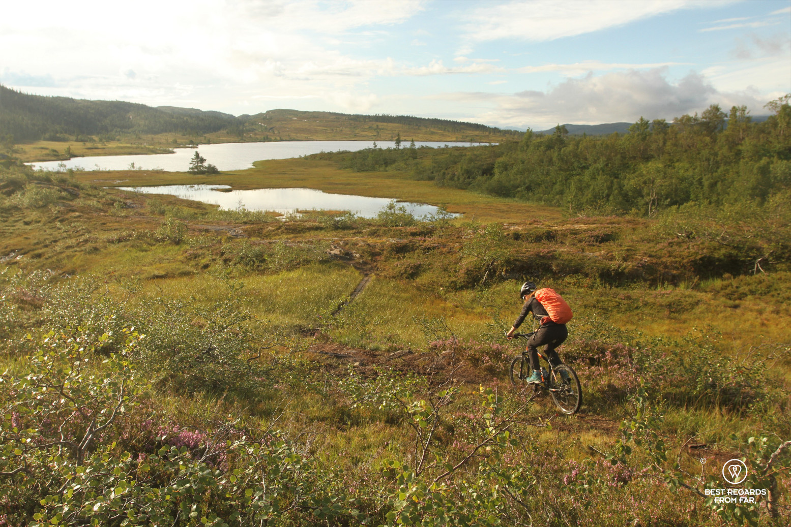
We locate the cabin on our phones, barely three kilometres from Sweden. The distance to reach the lost mountain farm where resistant fighters hid seems to be a bit far for a day hike, and we decide to mountain bike it instead. It looks OK on paper: 1,131 meters (3711 ft) of positive elevation to conquer over three mountain tops for a roundtrip of 44 kilometres (27 miles). “I am not sure anyone has biked it before, and you will have to carry your bikes at times” Skjalg warns us. With hardly any cell phone coverage, no escape road, nor settlement along the way, we check our gear and the weather carefully. Nights are already getting colder during this mid-August, and we enjoy the heat of the stove as we are planning our route on the map as a last preparation.
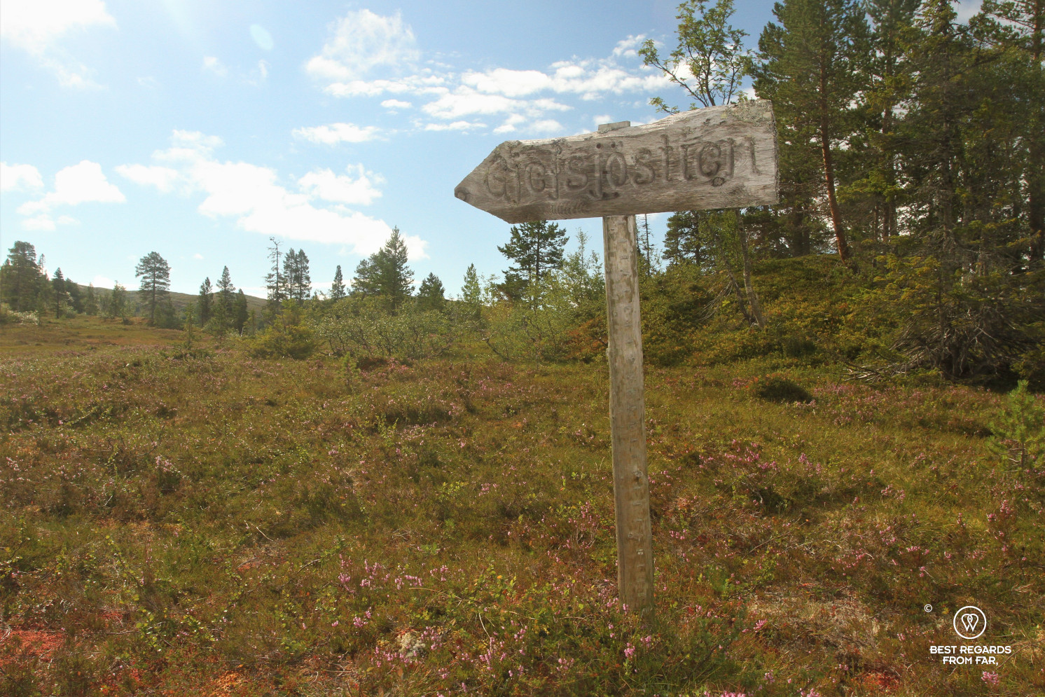
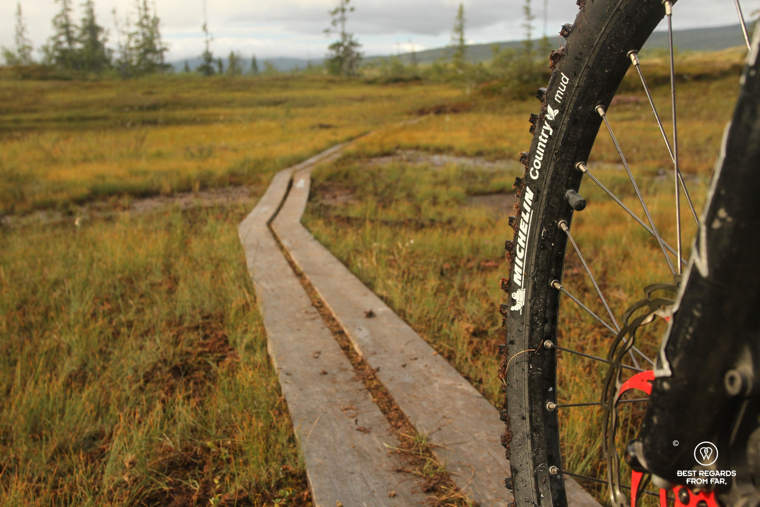
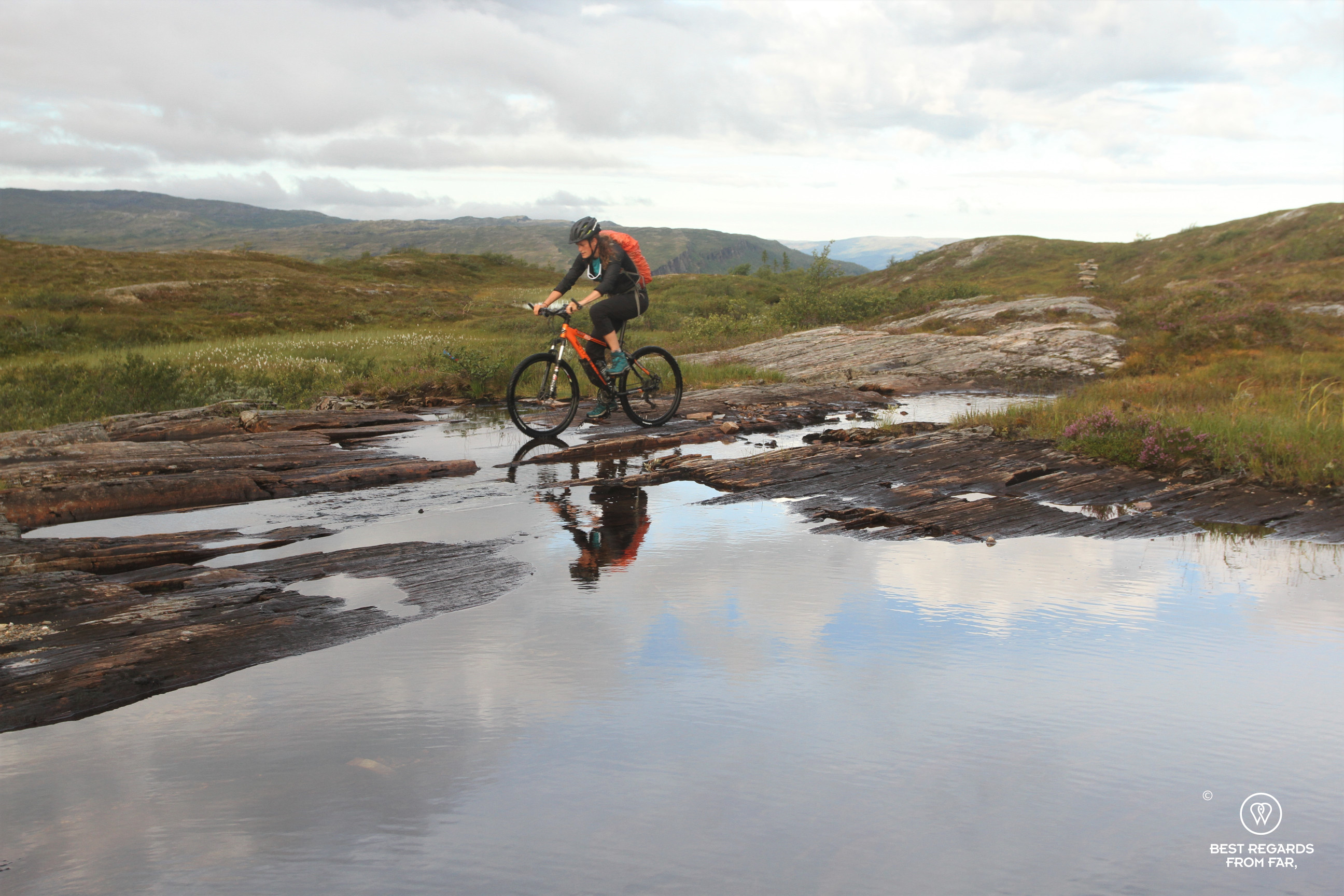
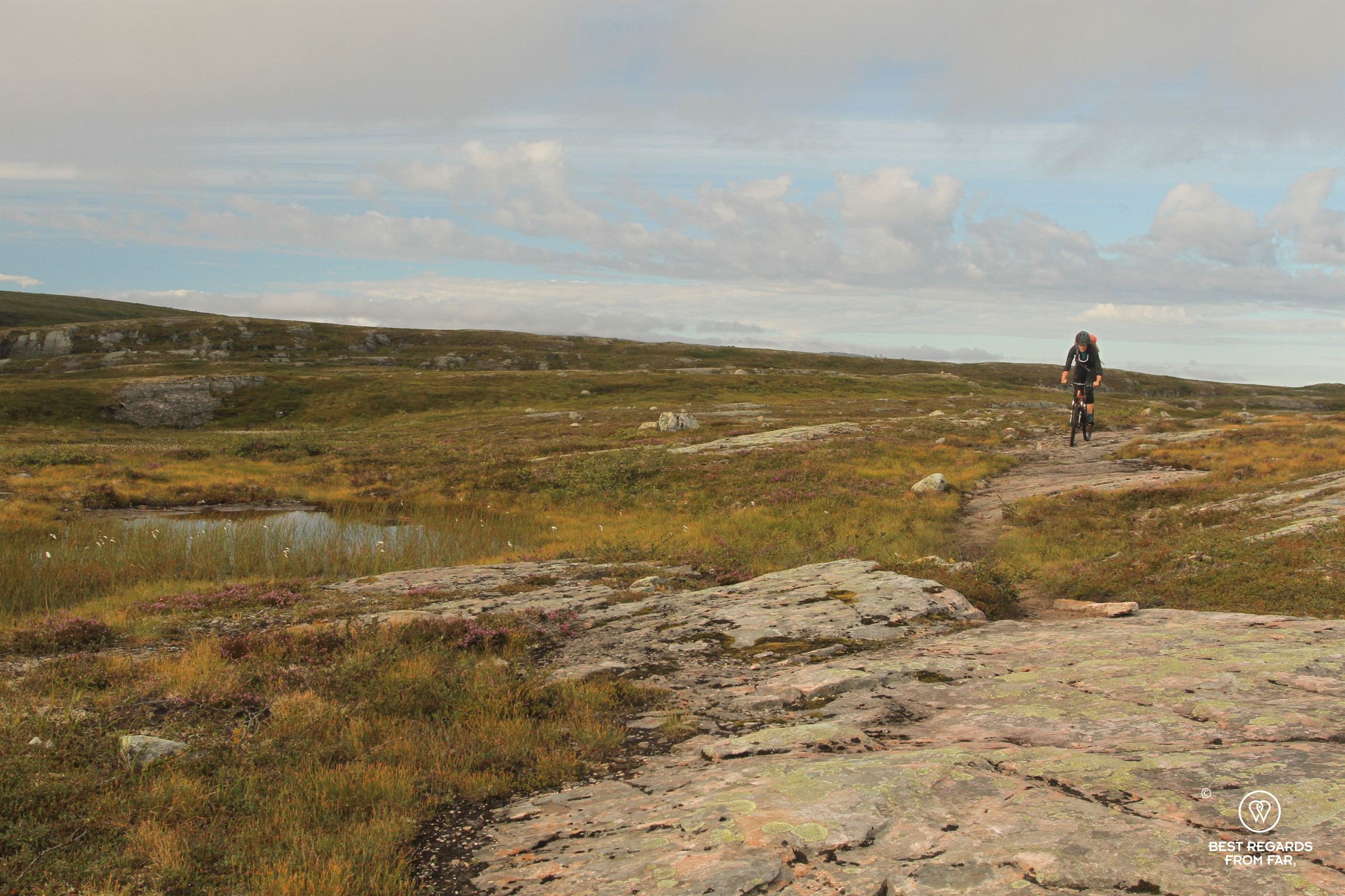
After a solid breakfast to try and limit the amount of food to carry, we realise early on the trail that it is going to be a tricky day, probably longer than expected. Recent rain has turned the track into a swampy mess! Looking at the vegetation, these seem to be the normal conditions around here, and the two parallel planks that are installed for hikers above flat parts from time to time confirm our impression. For us on bikes, they require the ultimate focus and balancing: too narrow to be relaxed, they are positioned slightly too far apart to be comfortable for riding and our wide tyres get stuck in-between regularly forcing us to a sudden stop, avoiding at all cost a dip into the swamp! We are almost relieved as the trail gains elevation over the first peak… The excitement stops soon as the 25 percent vertical gradient forces us to carry our bikes for most of the uphill. Luckily, the views on the low mountains, lakes and valleys are stunning! This may be one of the few places in Norway where the hydropower industry does not spin a web of powerlines all around.
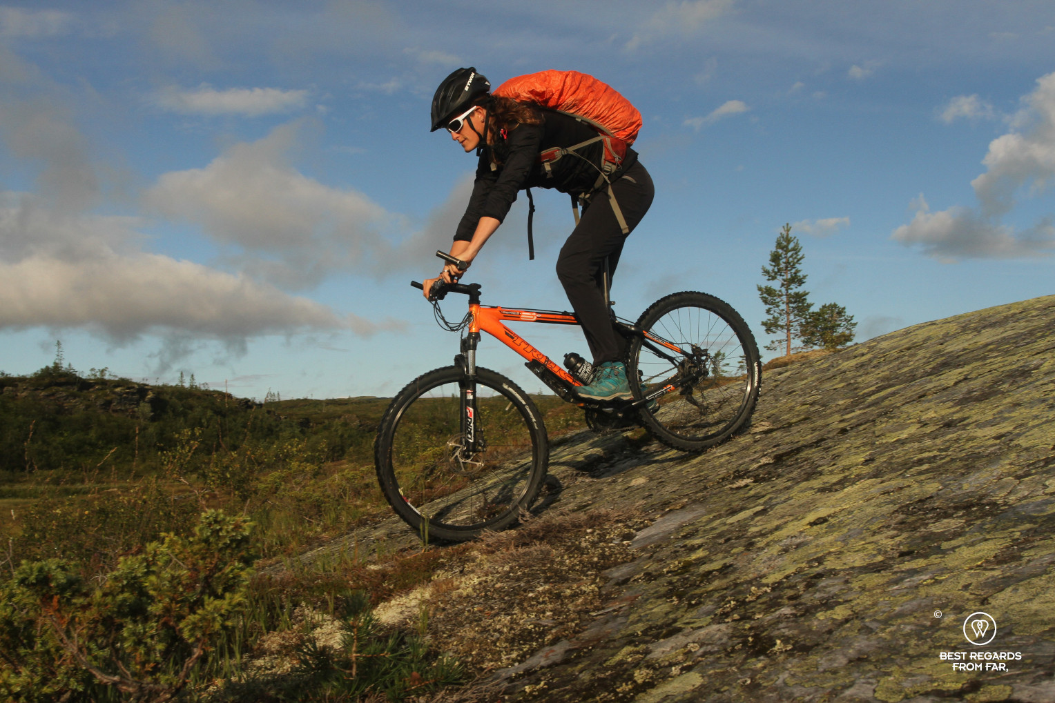

Once on top, a rolling section on large rock slabs and a smooth downhill make up for our efforts. The trail follows a small stream on a rocky path winding amongst patches of purple-blooming heather. The second uphill starts soon, as we are about to enter the Blåfjella – Skjækerfjella / Låarte-Skæhkere National Parks. As I am pushing my bike up a very steep section, I am so startled that I am incapable of making a sound to grab the attention of my companion quite far behind me: a lonely reindeer takes off, about three meters to my right, clearly surprised to see anyone in its mountains. It overtakes me with its clumsy nonchalant stride and large antlers, and draws half a circle while taking its distance to observe me. It simply stops, and we spend some precious minutes just looking at each other, before it decides to keep grazing further away. The scenic single-track winds its way through the grazing lands of reindeer, where the South Sami have been herding for centuries. Their reindeer roam freely, and every September, some of the males are slaughtered for their flavourful, nutritious and healthy meat, while their warm and beautiful fur and antlers are also precious to Sami craftsmen.


At the turnoff to the Lukkutjønnfjellet Mountain, a path leads to where a plane crashed in 1945. Skjalg’s story resonates: “The 12 men on board were on their way to the Gjefjøen farm to assist the Norwegian and American soldiers led by Major William Colby, who later became the director of the CIA. The plane crashed with its extra equipment and personnel and all men perished in the early morning of April 7.” It was a very demanding job to deploy, reinforce and supply soldiers for the Operation Rype in the remote mountains of Snåsa in challenging winter conditions. Pilots were operating at the edge of their plane ranges, and several aircrafts got lost. We salute from a distance to the large triangular memorial near the plane wreck which we can only guess, and continue to make our way up the third peak while keeping our eyes open for bears that frequent the forested area.

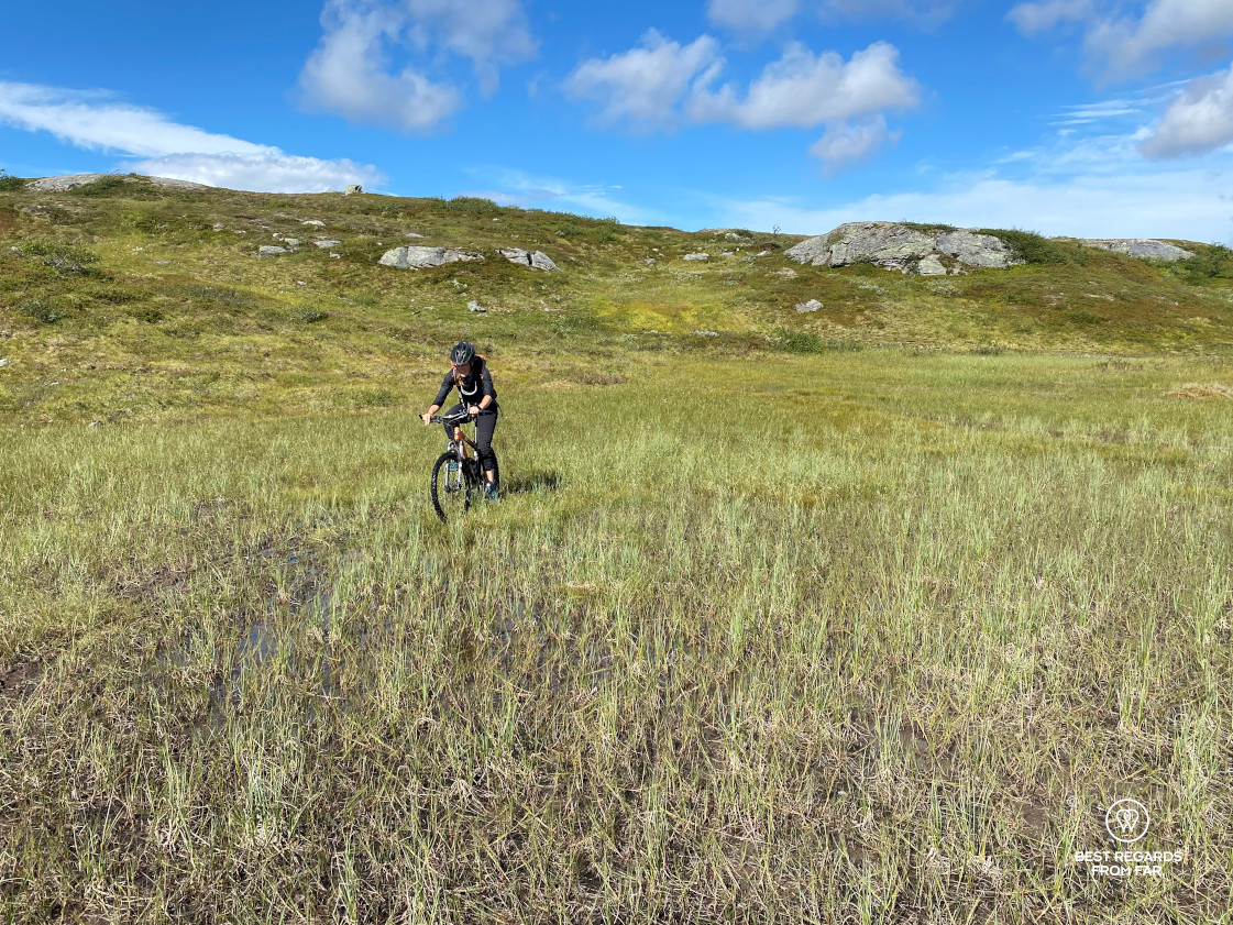

The way up the third mountain seems to never end but the sight of some sought-after cloudberries energizes us: we stop and, on all fours, look for the delicate berry, one of the arctic superfoods. After a few more reindeer encounters, in the distance we finally spot the lake along which the farm and former base of Operation Rype is situated. The elevation looks reassuring as we are happy to guess a few flats. However, given the swampiness, the flats are even slower to conquer than the elevated sections! Finding the right technique to cross the deceiving patches of swamps is delicate as the depth varies greatly. In one patch, going slightly too fast after a downhill, I get catapulted over my steering wheel as the sticky mud swallows my front wheel. Another time, going too slow, it is my rear wheel that simply sinks into the mud! There seems to be no proper way to handle the swamps, and we just have to push extra-hard on our pedals to slowly advance and it is exhausting! We eventually arrive by the lost mountain farm by the Swedish border.


The house that was used by the militaries is being reconstructed and will open soon as a small museum for tourists who are adventurous enough to take the long and beautiful trail. Rype was the only U.S. operation on Norwegian soil during the Second World War. An American airborne unit, part of Office of Strategic Services (OSS), the precursor of the CIA, was dropped in the Snåsa mountains on March 24, 1945 to sabotage railroads and prevent Nazi forces from withdrawing from Norway to reinforce other European war theatres. Led by Major William Colby, a few days before the liberation, the saboteur team was intercepted by a German patrol arriving at Gjefsjøen. Gunshots broke out and all five German soldiers were killed: this was the only direct clash between Germans and Americans in Norway during World War II.
We simply rest by the wooden cabin, thinking back to these troubled times from the brave Theta Group to the Falstad prison camp. Both exhausted, we know exactly what we have to overcome before making it back to the cosy Ismenningen Fjellstuggu before night… The Gjefsjøen summer mountain farm, where it is also possible to spend the night, is closed, so we eat our lunch fast as well as a protein-rich insect-based energy bar to try and resource.
It takes us another five hours to make it back. Through forestry sections, we spot some bear poo and see a few signs along tree trunks. Some more reindeer energize us as we see them in the distance. The only human being we meet is Jens Kvernmo, the Robinson Crusoe of Norway, famous for his survival skills in the wilderness – quite impressed to see us biking through his hostile and remote playground! This chit-chat gives us a confidence boost that helps us tap into our resources to complete our adventure. The sound of thunder and the dark clouds closing in on us release the adrenalin that pushes us over the very last peak.

Exhausted and satisfied after this full day mountain biking outing, we are enjoying the sauna and bathe in the cold lake of Ismenningen Fjellstuggu to rest our muscles, thinking back about the remoteness and vast wilderness of this area and its thrilling World War II history. Thanks to our kind host Skjalg, we feel privileged to have discovered such an untouched region, a true hidden gem, not written about in guidebooks nor blogs, where we crossed path with more reindeer than humans, secretly hoping to discover it one day in the winter…


Travel tips:
- On the opposite side of the lake, road 763 parallels the E6 and offers a great stop in Snåsa with its interesting South Sami Centre and beautiful surroundings.
- Make sure to spend a couple of nights at the Ismenningen Fjellstugu for a truly Norwegian experience in the wilderness.
- If you are to attempt this wonderful trail, whether hiking or mountain biking, we recommend you to spread it over two days, sleeping at the Gjefsjøen farm.
- Check out this interactive map for the specific details to help you plan your trip and more articles and photos (zoom out) about the area (short tutorial)!
For more awesome mountain biking around the world!