Reunion Island is a true hiker’s paradise. With hundreds of kilometers of well-maintained and well-marked trails crisscrossing the island’s mountains (listed as a UNESCO World Heritage Site), indigenous forests full of endemic species, rivers, striking viewpoints and isolated settlements, it might be hard to choose which hiking paths to take. To hit the most beautiful natural wonders of Reunion Island while experiencing the three very different amphitheaters (called “Cirques”) and meeting its inhabitants walking the most scenic trails, we have created an exclusive 7-day circular hike for you!
The city of Cilaos is the perfect point to start and finish this memorable hike. This quiet mountain city has plenty of supplies (including the famous lentils, the best potato cakes of the island, and outdoor gear), a wide range of accommodation including comfortable 4-star hotels, good restaurants, and a spa which waters have been healing rheumatisms for over 200 years: a treat for sporty people.

Day 1: Cilaos to Gîte de la Caverne Dufour (8.1km, +1,640m, -400m) & Piton des Neiges (6.7km, +/-600m)


After a good night sleep in a comfortable hotel (gîtes and dorms are coming up for the next week!), start early from Cilaos and walk its quiet streets towards the trailhead to la Roche Merveilleuse. This first viewpoint on the city and Cirque of Cilaos gives you an idea of what to expect on the way up. The rewarding views will be welcome today as it is a tough way up to the gîte, and then to the summit of the 3,071-meter high Piton des Neiges (Snow Peak), the highest peak of the Indian Ocean.


It starts getting serious passing the parking lot of Le Bloc. The almost vertical climb is very demanding and the shade of the forest a relief. Slowly the vegetation changes from humid forest to smaller trees covered in bearded moss. Volcanic stones replace tree roots to form the staircase up to the Gîte de la Caverne Dufour (book here).


Take a good rest at the gîte, and keep an eye on the ever-changing weather (especially in the rainy season): if the sunrise up the Piton des Neiges is very popular, the sunset is magic (and also quieter and will better balance your Day 1 and Day 2 of this itinerary), and comes greatly recommended. Count roughly 2 hours up to the summit and 1 hour down.
This may not be your most comfortable night as the gîte is more a mountain refuge (and only dorms are available) but be sure that dinner will be good with rice, grains and a cari or rougail and will give you the energy you need for the next day while the rum will keep you warm!
Day 2: Gîte de la Caverne Dufour to Gîte de Bélouve (8.5km, +100m, -1,000m) & Trou de Fer (8.3km, +/-140m)

If you want to see the sunrise from the Piton des Neiges, you will have a long day and an early wake up.
After breakfast, head out towards Bélouve. With a bit of rain, this hike turns into a canyoning adventure that will test the waterproofness of your gear to the limit! If the elevation graph makes it an easy day, pay attention to not misstep as the irregularities of the path make it tricky.
Landscapes are very different during this second day as you slowly step into the humid forest. Don’t be too cautious with your first puddle of mud… there will be many more to come, so just plunge in! Slalom between the trees, above and under and appreciate the omnipresent flora and exotic birds.


Once in Bélouve, put your backpack down and take a rest at the gîte. Then go on the 8km easy hike through the Tamarind Forest to admire the Trou de Fer, the island’s most majestic waterfall.


The cozy atmosphere of the Gîte de Bélouve (book here), the friendliness and great cooking skills of the keepers, and the peacefulness of the place with its amazing views on the Piton des Neiges and the Cirque de Salazie will make it an evening to remember.

Day 3: Gîte de Bélouve to Le Bélier/Grand Îlet via Hell Bourg (15.3km, +1,170m, -1,400m) & Trou de Fer (8.3km, +/-140m)

The morning starts with plunging steep down into the Cirque de Salazie (meaning good place to camp in Malagasy) to the village of Hell Bourg. The charming and peaceful small town is a nice stop for re-supplying, sending a postcard from its cute post office and enjoying a cup of coffee on the square before heading back on the trail. A few kilometers of asphalt provides a break from the uneven path.


Past Bras Marron, take the trail to Trou Blanc, another stunning waterfall. Despite the fact that this stretch shows a bit more elevation than the GR R1, it is often easier due to overgrown vegetation on the GR (especially in the rainy season).

The last part of the day up to Le Bélier makes you want to arrive and enjoy a cold drink. Don’t be too hopeful though, Le Bélier is a tiny settlement (where it is possible to sleep in a few guesthouses) and your chances are greater in Grand Îlet, about 3 kilometers further uphill. Understanding locals will be more than happy to give you a ride! Grand Îlet is also a good spot for a bit of re-supplying before getting into the isolated Cirque de Mafate.
Day 4: Le Bélier/Grand Îlet to Îlet à Bourse – step into Mafate (11.7km, +600m, -1,000m)!

Get a ride up to the trailhead or catch the bus and get back on the trail. After taking altitude along the road, enjoy the scenery on the islets and the Cirque de Salazie, and plunge into Mafate on the Sentier Scout. This beautiful trail will take you down (and only very slightly up) to Îlet à Bourse. Hiking, you will understand why the slaves who escaped (called “maroons”) fled to Mafate to hide. Actually, the name Maffack was one of the maroons who fled to this area in 1751. Shortly after, the slave hunter François Mussard found him and the others of his group. Maffack was killed and his ear brought back so that the slave hunter would get paid by his owner as carrying a whole body on these trails was hardly possible. Maffack was buried where he died, and his tomb became a landmark, eventually giving the cirque its name: Mafate. Today the cirque remains very difficult to access and inhabitants of these isolated settlements that can only be reached on foot or by helicopter will warmly welcome you in their gîtes.


The path offers stunning views and a few rivers make for some nice refreshing halts before the steep and short uphill to Îlet à Bourse.
Crops on the side of the trail announce the settlement with its small school (at the time of writing, 6 kids from 4 to 10 were studying there), dispensary, spread habitat, and cute and welcoming Gîte of Îlet à Bourse (book here) where a warm shower and a good meal will be waiting for you.


Day 5: Îlet à Bourse to Îlet des Orangers (9.5km, +900m, -700m)

As the sun slowly bathes the islets of Mafate and the Piton Cabri, leave Îlet à Bourse to head to Îlet des Orangers. Today, conquering a few steep up- and downhills (with the Rivière des Galets providing a good opportunity to cool down before an infernal climb!) you will be passing by many islets such as Grand Place, Cayenne and Îlet des Lataniers before reaching Îlet des Orangers, the most remote of Mafate.


It stands proudly as a fortress protected by the brutal verticality of the Cirque. Today, about 80 people populate it living close to each other on the few flats that can be built, growing fruits (oranges, lemons, pineapples, avocados…) and vegetables (corn, green beans, green peas…), and breeding some chickens and goats.


To take in the splendid views and experience the remoteness, push to the Gîte de Bellevue, where a good meal served by the most welcoming host will help you recover.
Day 6: Îlet des Orangers to Marla (14.1km, +1,350m, -850m)

After admiring the view one more time for breakfast, head out rather early as today is a long day. It starts with getting up to “La Brèche” where the trail meets with the one going up the Maïdo – one of the entry/exit points into Mafate.


After taking in the view on the Piton du Maïdo, step down towards Roche Plate a quiet but rather large islet. Two ways are possible to reach Marla: via La Nouvelle (one of the most developed islets as it is close to Col des Bœufs, a popular entry/exit point) or via Trois Roches. The latter will take you along the ramparts towards the waterfall of Les Trois Roches where you will have to cross the Rivière des Galets and push upstream leaving the way to Col des Boeufs to your left. Further uphill along the GR R3, you will soon arrive in the cute Marla with its spread habitat at the foot of the Col du Taïbit, your way out of Mafate and back to Cilaos.


Once settled in the comfortable Gîte de Marla (book here), take in the view on the emblematic Trois Salazes and Pluto (click here for an adventure of a lifetime!), on the Grand Morne hiding the Piton des Neiges you climbed on Day 1 and the Grand Bénard. In the far, contemplate the Maïdo Peak and guess Roche Plate at its foot, try and identify the islets you walked by. Enjoy your last night in Mafate with an excellent dinner and rhum arrangé before admiring the stars and taking a well-deserved rest.


Day 7: Marla to Cilaos (11.9km, +1,100m, -1,300m)

Walking up the Col du Taïbit will reward you with breath-taking views on Marla and Mafate to climax at the col. The helicopter traffic is probably already hectic in Mafate by the time you get there between tourists’ flights and supply and trash pickup. On the other side, you will be back in the Cirque de Cilaos where you started from.


At the road, make sure you continue towards Cascade Bras Rouge to enjoy the waterfall and a last swim before Cilaos.
You will start seeing more day hikers and soon you will arrive by the spa of Cilaos you may want to visit soon for a hydro massage bath… For now, walk back to the comfortable Tsilaosa hotel to enjoy a well-deserved shower, a delicious dinner at Chez Noé and thick mattress to rest after this magnificent 7-day trek that offered you the best of Réunion Island!


Text & photos: Claire Lessiau & Marcella van Alphen
Travel tips:
- Some gear essentials beyond the trekking basics: a headlamp (night falls very quickly here and without a light it is very easy to get lost), a rain jacket and down jacket, good GoreTex hiking boots, hiking poles, a towel (bed linens are provided in all the gîtes and you may want to carry a silk bag for the first night), ear plugs for the dorm, cash (don’t count on credit cards).
- Note that there is an excellent cell phone and data signal throughout the hike.
- Power is available in every gîte and often running on solar (during the high summer season, access to a power outlet may be a challenge).
- Once in Mafate, trash has to be helicoptered out, so please, take your trash with you out of the Cirque.
- Once back in Cilaos, treat your tired muscles in the spa Les Thermes de Cilaos where the mineral waters heated by volcanic activity will do you some good.
- In Cilaos, we recommend the Tsilaosa Hotel**** that is a very comfortable 4-star where your additional luggage can be stored safely during your hike.
- Check out this interactive map for the specific details to help you plan your trip and more articles and photos (zoom out) about the area! Here is a short tutorial to download it.
Like it? Pin it!


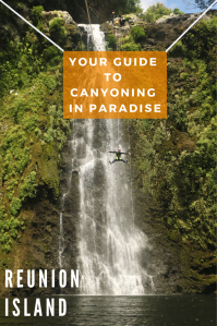
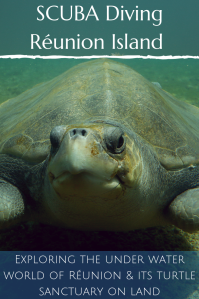
What esle to do in Reunion Island: just click on these images to get inspired!


For more awesome multiday hiking adventures, click on one of these images:


This looks like a spectacular hiking experience. Thanks for all the detail.
Thanks for your comment. Reunion is really a hiker’s paradise and this specific loop sums it all up. If you ever go, don’t hesitate 🙂
What a stunning hike!!! Reunion Island does not have very large predators~~~ so even wild hikes are relatively safe. *it maybe an Aussie joke (I am a South African though :P)
You are entirely right Joyce, no black widows nor nasty puff edders here (not anyone getting mugged on the trails either – maybe a bad South African joke ;-)) It does make it very safe and enjoyable to get into the wild. (We are both in love with your country- where are you from?)
Wahaha yes, mugging. That’s the spirit of a good SA joke 🤣 I was from Cape Town, but I now live in Paris. Happy that you love SA. 😊