Article updated on February 18, 2022
Text: Claire Lessiau & Marcella van Alphen
Photographs: Claire Lessiau & Marcella van Alphen
“Look at those giant ragged shapes on the horizon! It looks like a draak!” One of the early Voortrekkers could have said.
“I am not sure we can go any further! A barrier of spears is blocking us” A Zulu warrior might have said.
Draak is Afrikaans for dragon and the Zulu warrior and Afrikaner were talking about the same mountain range: the Drakensberg, or dragon mountains.
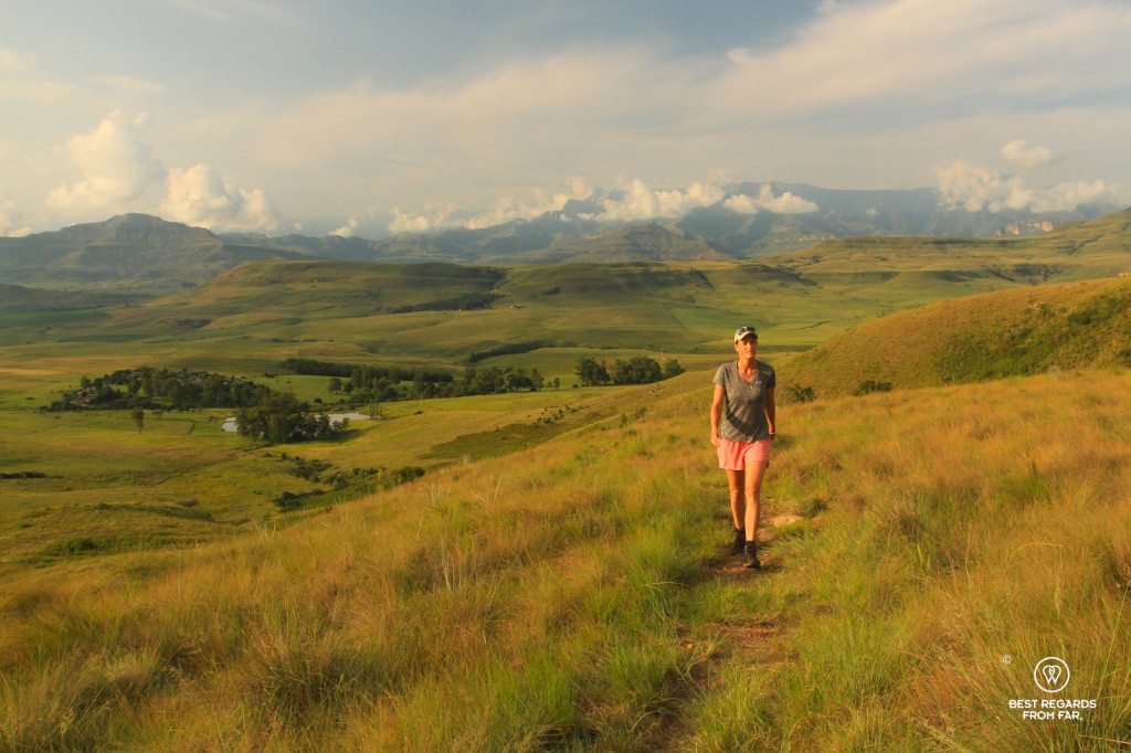
The mountain range stretches for about 1,000 kilometres (620 miles) from the Blyde River Canyon to the Eastern Cape with Lesotho on its high plateau, where the most famous part of the Drakensberg culminates at 3,000 metres (9,850ft) in the South African province of KwaZuluNatal. It is not only famous for its cultural value of the Bushmen rock art but also for its biodiversity and stunning landscapes: it is the perfect playground for some serious adventures, from mountain biking to moderate to strenuous hiking and swimming in natural rock pools!
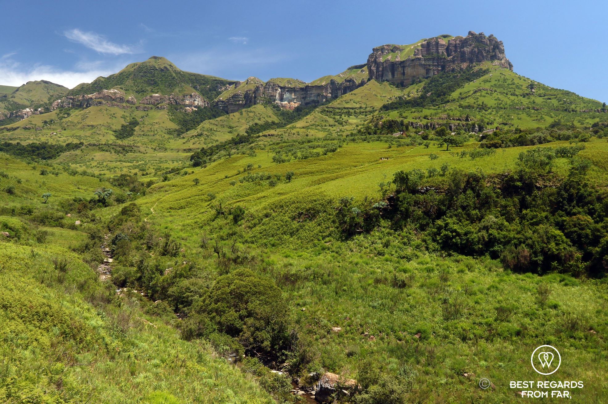

At the foot of the Amphitheatre, down in the Tugela Gorge, we have a hard time taking the measure of it. In the background, a terrain as old as Africa reveals itself in a 7-kilometre (4.3-mile) wide half-circular wall of rock that is one-kilometre (0.6-mile) high. The dramatic Amphitheatre is where world’s second highest waterfall drops 850 metres (2,800ft) down from the plateau of Lesotho into the Tugela Gorge. It takes every visitor’s breath away. Downstream, where we are standing by the scenic Tugela River, the water has dug an impressive gorge with tunnels surrounded by caves, smaller waterfalls and swimming holes among protea trees and forests hosting an abundant wildlife.


It is only once up the Amphitheatre, after a sporty hike that goes up thrilling chain ladders that we get a better feel for the scale of the site. Or that we are trying to, as thick white clouds are blocking the view and make the path hard to find. Up on the plateau, we can hear a waterfall. Looking at the trail route on our GPS, it must be another one. Somewhere. Close by. We keep walking in the clouds towards the Amphitheatre. Suddenly, the sun seems to pierce through and looking up, a small clearing between two thick clouds seems to widen under the influence of the strong winds. We instantly start running like mad women with our rucksacks bouncing on our backs, hoping we will cover the remaining 700 metres (0.4 miles) on time to at least get a glimpse of the Tugela Fall…

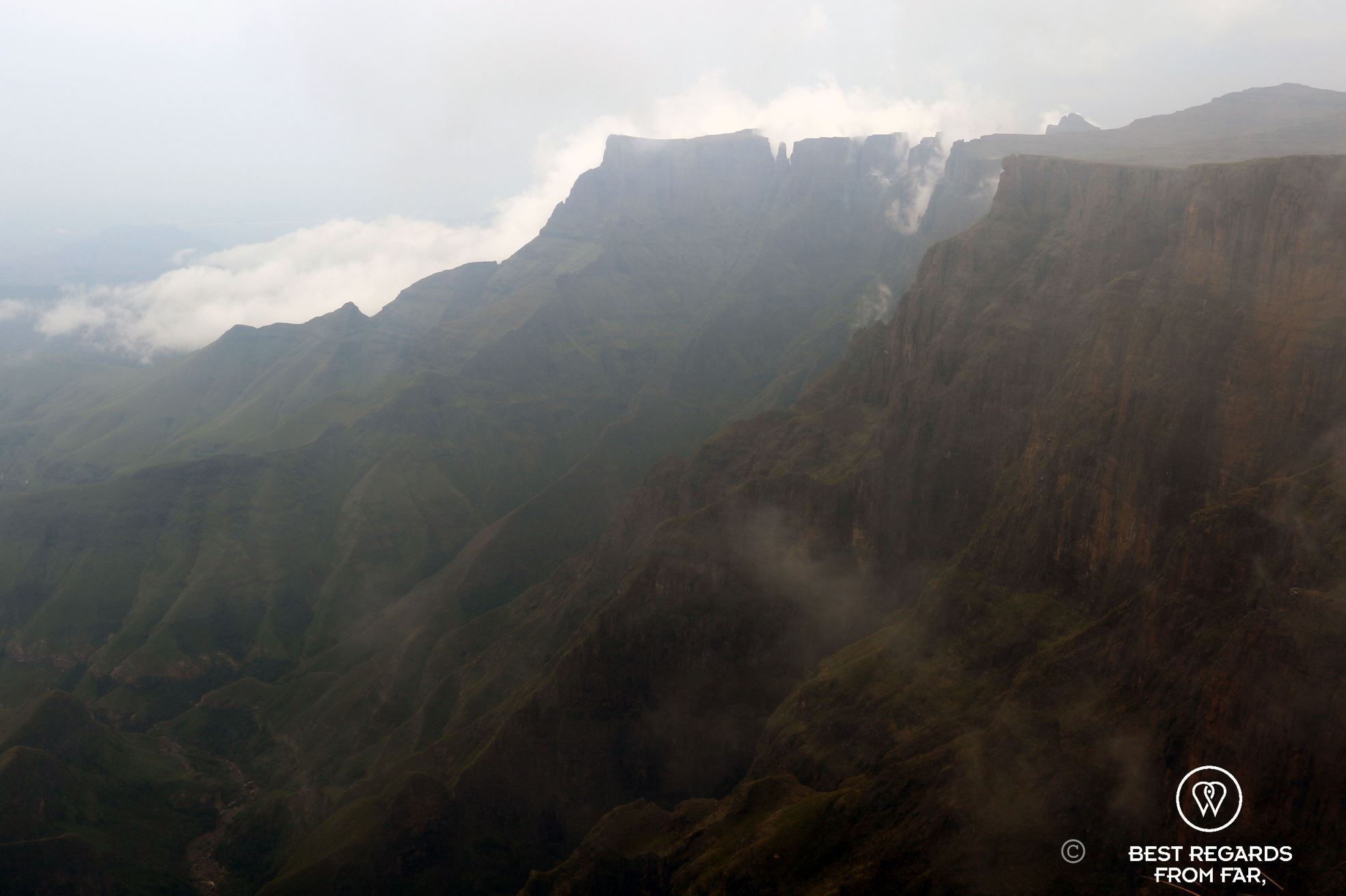

“Never anywhere, before or since, have I beheld such a glorious sight, or one of such stupendous magnificence and savage grandeur. Neither cloud or mist obscured our view, and there we sat perfectly entranced, never thinking of the flight of time, drinking in the beauty of the landscape, which lay stretched out, a glorious phantasmagoria, thousands of feet below.” wrote J.W. Matthews in his memoirs in 1887, the earliest visitors to go up the Amphitheatre. The scene he depicts has not changed much in over 135 years and we are both in awe as the weather clears up and allows us to observe the gorge down below where we hiked and swam, the proud Sentinel guarding the majestic Amphitheatre and the Tugela Falls.


Travel tips:
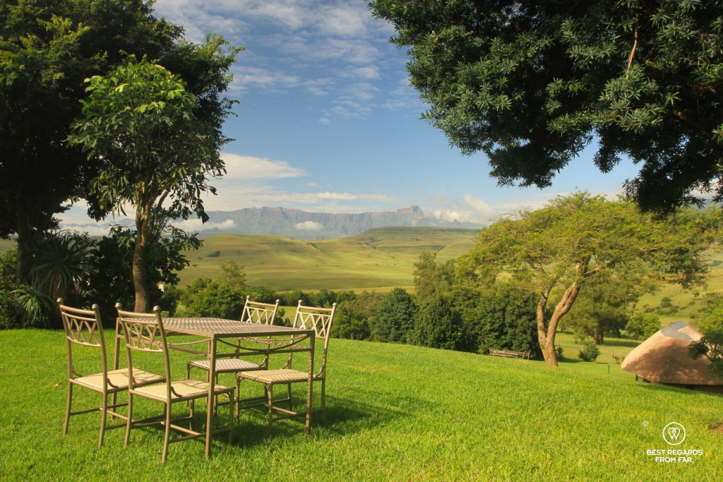
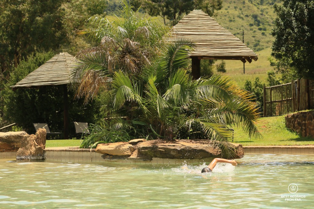
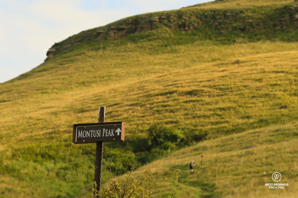
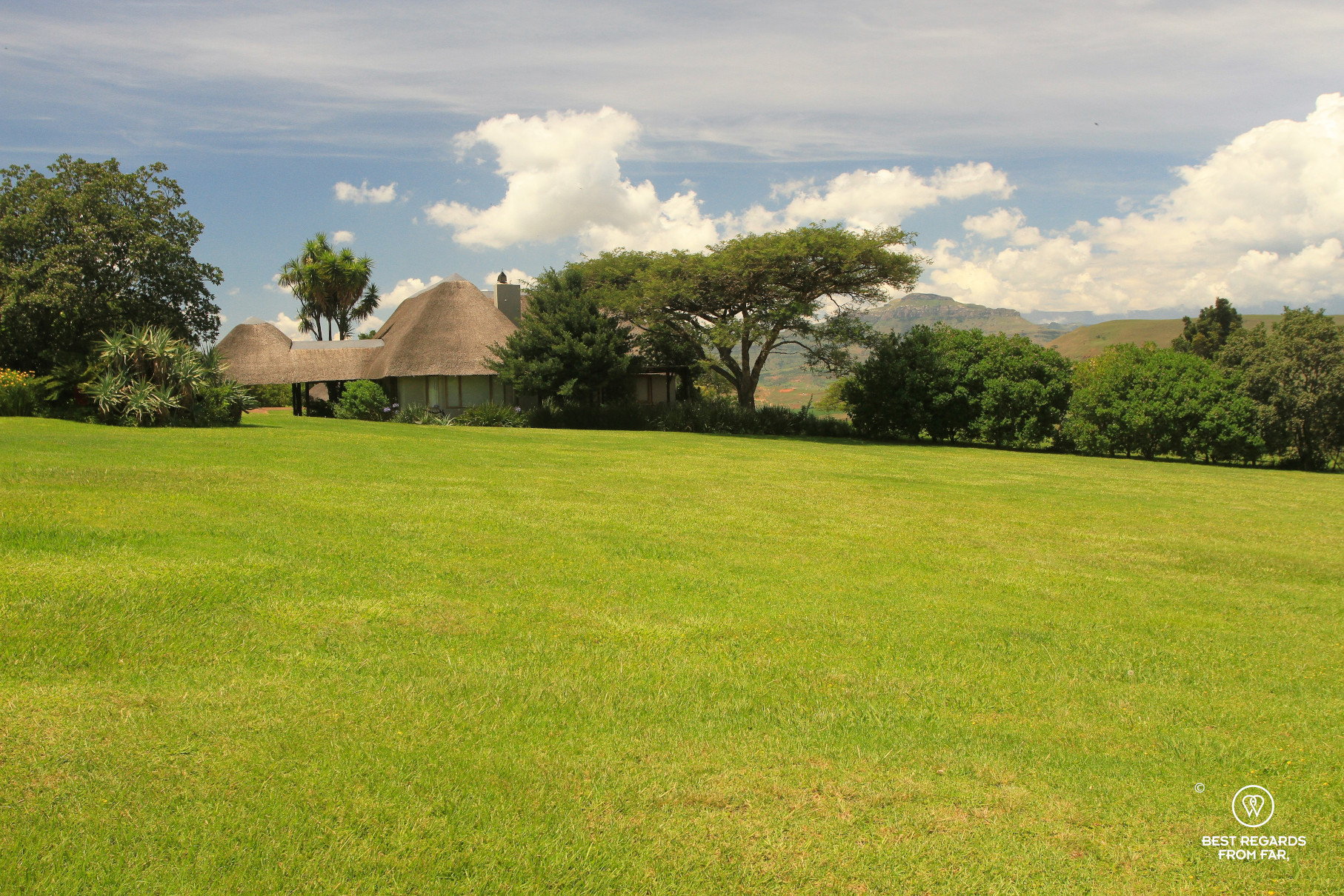
- To explore the area, stay at Montusi Mountain Lodge located only 3 kilometres (less than 2 miles) from the trailheads. Designed to blend in with the natural environment, its private trails are interesting to hike to discover Bushmen cave paintings, amazing viewpoints and waterfalls, and pamper in the most comfortable lodge of the area. The Montusi Mountain Lodge is a family business that supports local communities funding education, promoting local initiatives by buying local, and employing staff from the nearby village.

- The Tugela Fall hike can be done from the Royal Natal Nature Reserve. The hike is about 38 km (23.6 miles) round trip and will require a long day, including about 7 km (4.3 miles) on a dirt road right before it joins the top part of the trail which GPS track is provided on the interactive map below.
- The other option is to drive around the mountains to start at the top of the trail, making it a 14-kilometre (8.6-mile) hike round trip. A very bumpy dirt road has to be driven and a high clearance vehicle is preferred (transport is also available from the park entrance to the top: inquire about times before you head out). The trail is well trodden and a guide is not necessary: the downloadable GPS track provided on the interactive map below is sufficient.
- The weather can change very quickly and it can get very cold, rainy and windy: be prepared!
- Check out this interactive map for the specific details to help you plan your trip and more articles and photos (zoom out) about the area! Here is a short tutorial to download it:

Amazing! I love your stories, experiences!
Thanks for your read Heather. We hope to inspire you through our stories about our experiences in this fantastic country 🙂
One of my dreams after reading “Le vautour attend toujours” de J.H.Chase
I didn’t know it took place there. I’ll give it a look. Thanks for your read and comment!
Stunning but I would not be going on that chain ladder (ever). I just saw Vic Falls in Africa in December … wow.
Nice! We haven’t made it to Vic Falls yet. That must be quite an experience. Lucky you!
About the adventure book, the name of the region was The Natal. Now the name is KwaZulu-Natal.
Yes, a truly beautiful region!!