Text & Photographs: Claire Lessiau & Marcella van Alphen
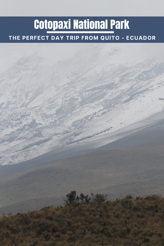
Ecuador is renowned for its dramatic volcanoes of the Andes that dominate the skyline. Among them the iconic—pun intended, Cotopaxi, its second highest that culminates at 5,897 meters (19,347 ft) is one of world’s highest active volcanoes. Continuously monitored because of its proximity to the country’s capital Quito, Cotopaxi offers visitors far more than just a photogenic quasi-perfect volcano cone. A day trip into its namesake national park allows you to explore its fragile paramo ecosystem, its snow-covered slopes, and its wide-open landscapes where wild horses roam freely, rare hummingbirds fly by, and other wildlife can be observed by 4X4 or even better during a horseback riding outing led by a chagra —the local cowboy.
Pin it for later!
Leaving Quito along “The Avenue of the Volcanoes”
We depart Quito early and drive South on the Pan-American Highway through the section that is nicknamed the Avenue of the Volcanoes, a belt of stratovolcanoes forming this part of the Andes. About 150 million years ago, the subduction of the Nazca plate beneath the South American plate gave rise to many volcanoes, including today’s world’s highest (Ojos del Salado (6,893m/22,615ft), further South in the Andes in the Atacama Desert). The 60-million-year-old Cotopaxi, the second highest mountain in Ecuador, used to be the highest active volcano in the world until the Tupungato (6,570m/21,555ft) in Chile woke up in 1987.
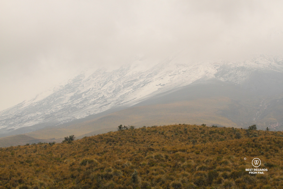
After about an hour and a half, we enter the official boundaries of Cotopaxi National Park. Beyond the mythical volcano lies a fragile ecosystem. Below the eternal snow of Cotopaxi (4,900m/16,076ft to 5,897m/19,347ft) that have been almost halved between 1976 and 2006, the hostile sub-paramo (3,400m/11,155ft to 3,900m/12,795ft), paramo (3,900 m/12,795ft to 4,400m/14,436ft) and super-paramo (4,400 m/14,436ft to 4,900m/16,076ft) are home to native Andean animals such as the spectacled bear, Andean fox, Andean condor, and Andean marsupial frogs.
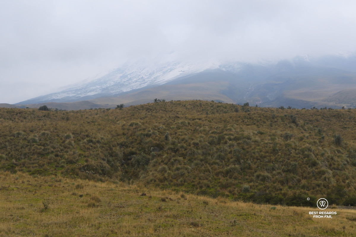
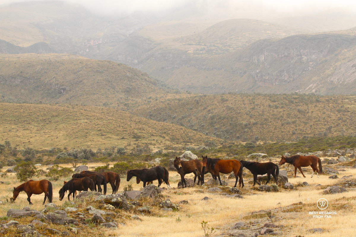
The road winds past a man-made pine plantation supporting the local building and paper industry, before entering a landscape of low forests, grasses, herbs, and mosses, typical of the sub-paramo grasslands. The road continues to climb, and we add a layer of clothing when we enthusiastically step out of the car to silently observe the first herd of wild horses that peacefully graze by one of the many streams in this alpine tundra. Focusing on the tiny world, we also notice the thin, hard, wax-coated leaves of most plants that have adapted to these harsh conditions by preventing water losses. Their hairs also protects them from the wind and form a sort of sheltering heat sink to maintain heat and humidity. Some are silvery in color: while the temperatures can drop drastically, the solar radiation is very intense at these latitude and altitude, and these super plants reflect the sunrays to not burn.
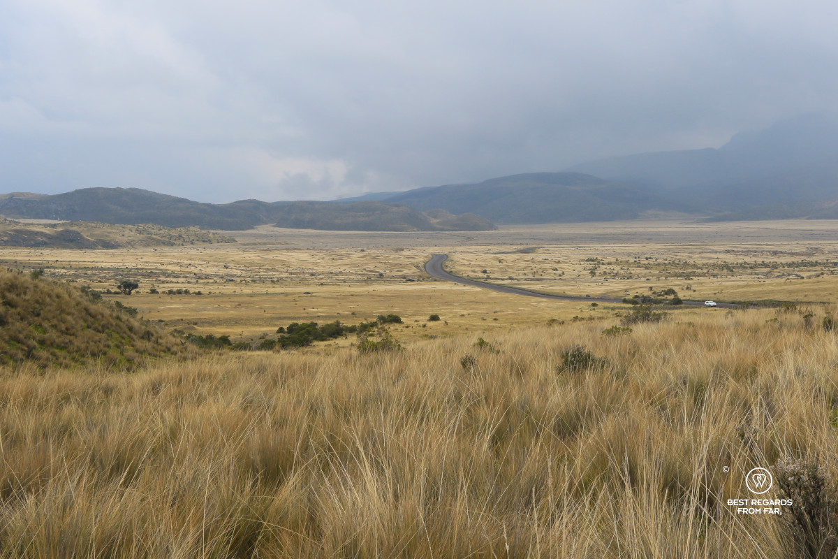
The landscape becomes more mineral as the plants get closer to the ground to conserve heat and resist wind. Yet the paramo we are now crossing is surprisingly biodiverse with about 60 percent of endemic plants—plants that exist only in this very local ecosystem. The road keeps climbing while the clouds thicken. Soon, snowflakes start falling on the now volcanic dark soil on which nothing seems to grow as we arrive at the highest point reachable by car at about 4,600 meters (15,092 feet) of altitude.
A Short Hike to the Refuge
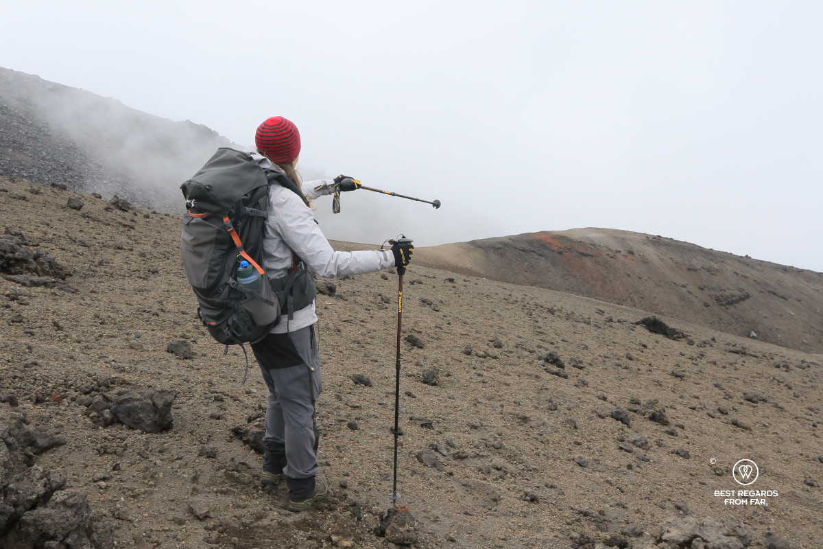
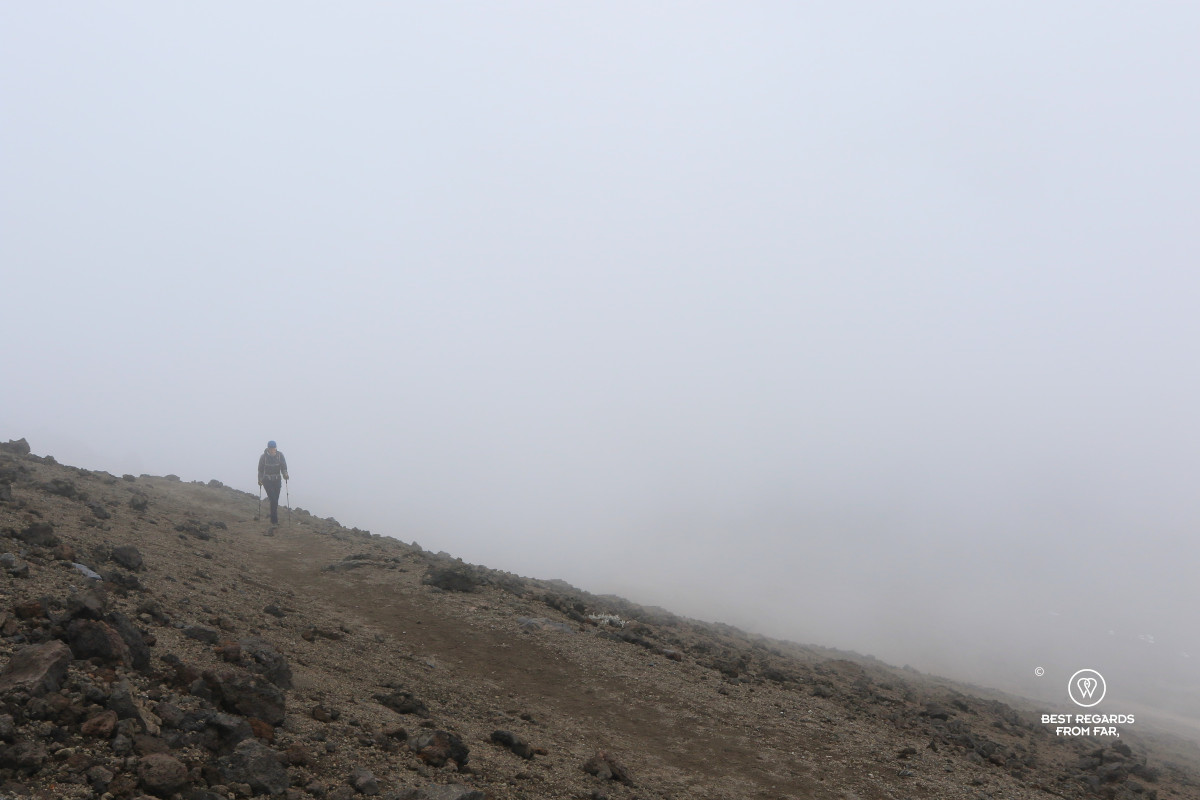
We get off and gear up for a short yet steep hike in thin air to the José Rivas refuge. More clouds gather while we walk up along the well-trodden volcanic trail in this mineral landscape high above the grasslands. The wind picks up, and flakes of snow begin to fall harder as we near the refuge. At 4,900 meters (16,076 feet), Cotopaxi stays well hidden in a thick cloud cover.
It is its shame says the legend. Cotopaxi had an affair with North lliniza Volcano (5,105m/16,749ft), but she was already married to the snow-capped South lliniza (5,245m/17,208ft). Rumiñahui Volcano, a good friend of the south summit of the double lliniza peak warned him of the affair. Then llinizas’ son, the Heart Mountain, wept so much that his tears formed the beautiful Quilotoa Lake, and since Cotopaxi often hides his shame in clouds, like today.
At other times, it bursts in anger. The first ever recorded eruption of Cotopaxi happened in 1534 while the natives were fighting against the Spanish conquistadors. In 1742, three major eruptions destroyed the Cutuchi River valley and the city of Latacunga, also destroyed in 1743, 1766 and 1768! The ashes reached all the way to Guayaquil along the Pacific Coast during the last eruption in the 18th century! Since then, ash eruptions and lava flows have happened repeatedly.
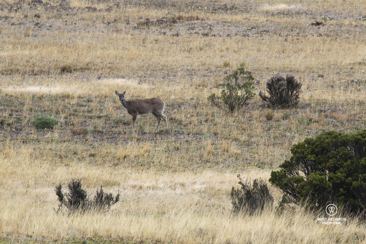
After warming up in the refuge with a hot chocolate, we zip down the slope of Cotopaxi fast, running in a straight line towards the car. The visibility is very low, and as we drive down, bits by bits, colors appear again. Some Andean deer graze in the distance. Closer, the wild horses of Cotopaxi can be seen again.
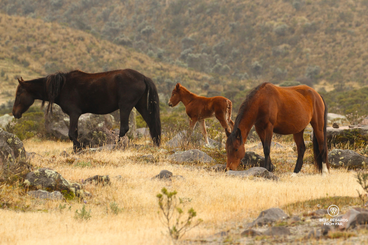
Wild Horses of Cotopaxi: 200 Generations of Freedom
The horses seem calm yet their wild spirits are palpable when I notice how fiercely the mares shield their young as we approach them. Horses were one of the most crucial weapons of the conquistadors in the 16th century, and some bands managed to escape.
Today, about 200 horses remain wild in this hostile landscape around Cotopaxi and have never been captured nor domesticated again after living in the wild for now about 200 generations.
Lunch at a Lodge with a View
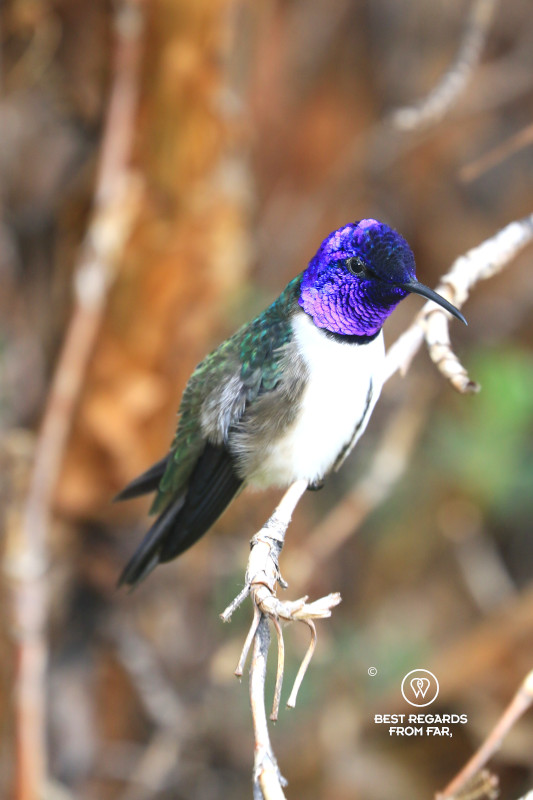
The Tambopaxi Lodge is set within the national park with unbeatable views over the barren volcanic landscape. Right as we are about to enter and shelter ourselves from the elements, a flash of purple catches my eye: a colorful hummingbird settles on a branch, allowing me to admire its brilliant colors. I aim my camera telephoto lens at it and approach step by step till my camera captures its purple glow. I am amazed by the adaption capabilities of these tiny birds. They take shelter from icy winds and rains that my technical gear hardly protects me from in small caves where they build their nest made of wool and plant fibers. At night, they lower their activity level and body temperature to conserve energy, and they can even hibernate.
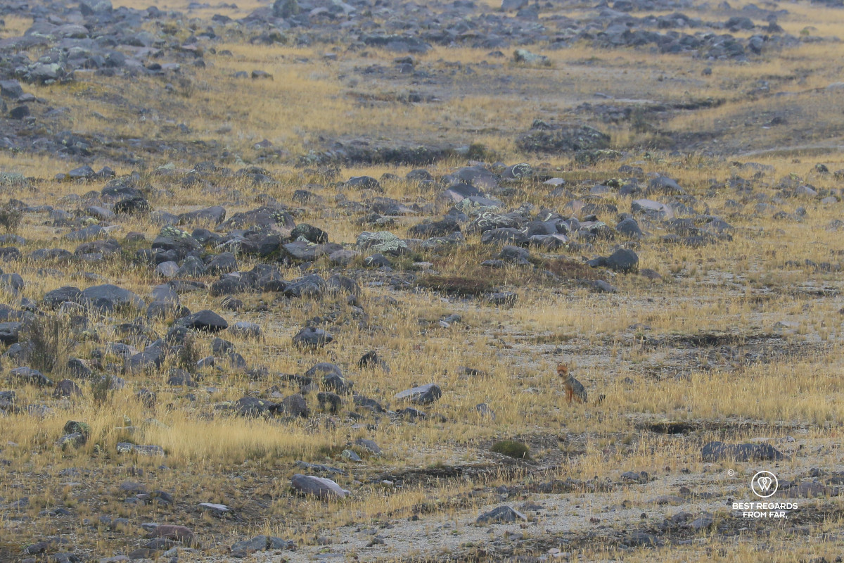
As we savor a hearty meal with amazing views over the alpine landscape and the hidden cone of Cotopaxi, two furry Andean foxes emerge from the high grass. They are foraging for food, and disappear fast as the rain kicks in and dark clouds approach to the sound of thunder. Lightning strikes over the grassy landscape while I take in the beauty of this rugged and hostile nature.
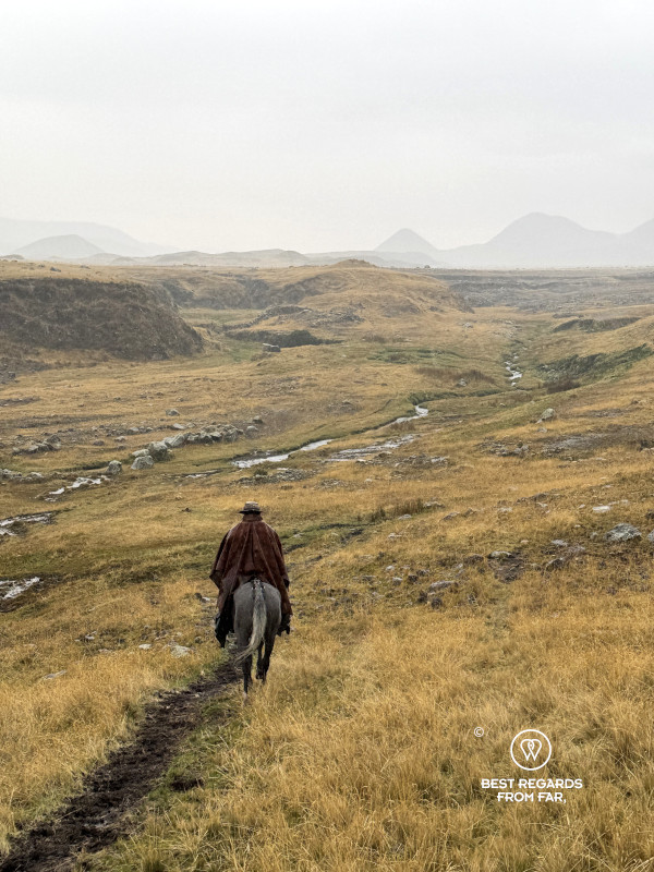
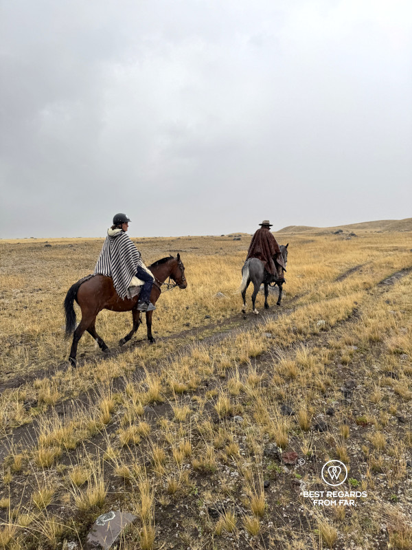
Horseback Riding with a Chagra Cowboy
We meet a chagra, one of the Ecuadorian cowboys who for centuries have been herding cattle here in the high Andes on horseback. Dressed in chap made of sheep hide, and protected by a thick poncho with boots, spurs and gaiters, he secures his hat firmly on his head to protect himself better from the rain. Clearly not impressed by the elements, he introduces us to his horses.
My fear of lightning seems to take the best of me as I am about to turn around to get back to the warm comfort of the lodge. Before I do so, I carefully observe his horses one last time. Like their chagra, they seem completely unshaken by the lightning strikes: I try to tune into their energy. They convey their calm and confidence to me.
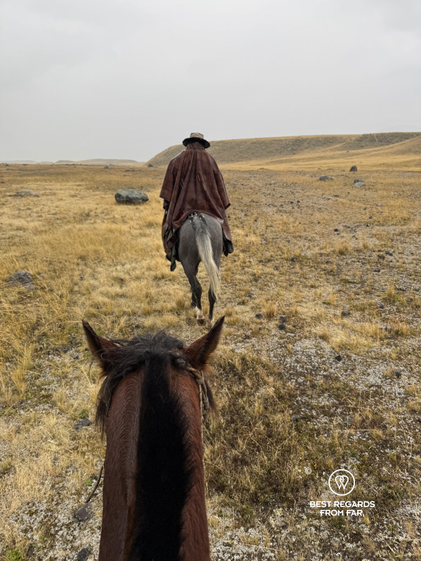
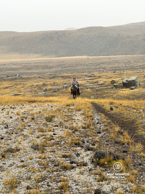
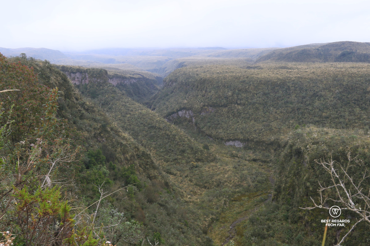
Within seconds, I put on the poncho our cowboy guide had ready for me and I hop on my strong horse. We follow our cowboy guide across the paramo, under the downpour. We trot down into canyons, take in the ever-changing view when suddenly his horse rears. Trying to see what is happening, I notice a band of wild horses. I command my horse to keep moving forward. They all acknowledge each other’s presence and we pursue our route, galloping across the high plateau. I feel the rain on my face, the cold wind in my hair, and my soaked pants clinging to my skin as we speed through the wet grass. We jump over small streams and I no longer worry about the thunder becoming one with my horse in a dazzling rhythm over the seemingly endless plains. There are no other signs of civilization around, just the unfavorable elements that reinforce the wild nature we are passing through. The sense of freedom as we are galloping across the paramo with dramatic volcanoes in the background overwhelms me. I find myself in a state of total bliss, embracing the moment fully despite the horrible weather, feeling so alive that it puts a huge smile on my face. My horse is alert and steady. His wet mane is stuck to his neck. In the distance I observe three white-tailed Andean deer and praise myself for not missing out on this ride of a lifetime, so proud of having conquered one of my deepest fears.
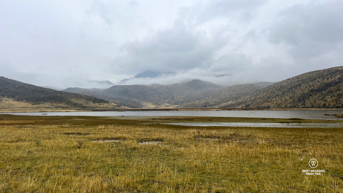
Bird-watching at Laguna Limpiopungo
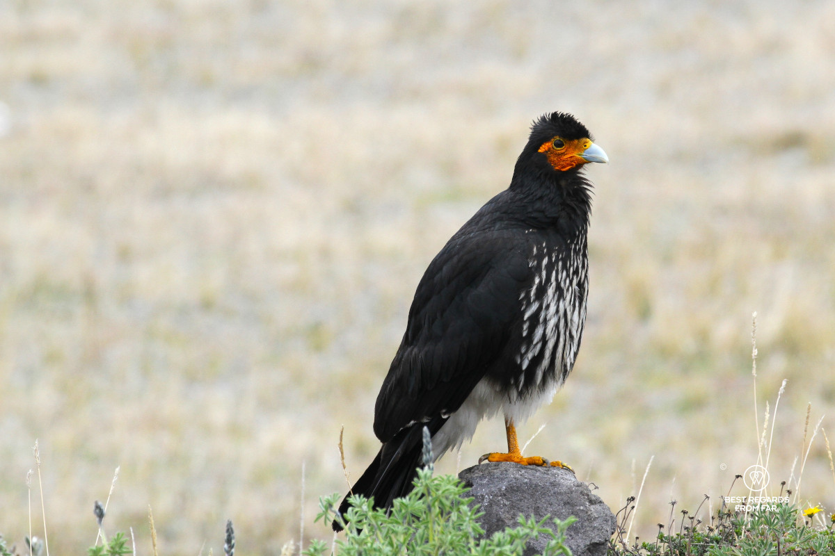
After our unforgettable horseback riding adventure, our guide drives us to the Laguna Limpiopungo, a shallow high‐altitude lake known to be a fine bird‐watching spot with about 45 recorded bird species. We take in the scenery from the car while the afternoon light softens. The lake is fed by rainfalls, groundwater and thaw. We scan the marshes and open water for Andean geese, Andean lapwings, plovers, and ducks that are going about their day. We try to spot the rare Andean condor that regularly dominates the sky here but have no luck today. Rain keeps falling, ruining the moment for good photographs, but it is all part of the adventure. While we move on, a Carunculated caracara seems to be able to read my frustration at missing good shots and eagerly poses, showing off its impressive plumage.
***
We reach Quito by nightfall and look back on a rewarding day in Cotopaxi National Park. The inhospitable terrain, ever-changing skies, and wild landscapes contrast sharply with the craze of Ecuador’s capital. For travelers seeking a short but compelling escape from Quito, this high-Andean playground is one to be experienced and remembered.
Travel tips:
- Make sure to pack raingear and a dry set of clothes for after the horseback ride, and to wear layers as the weather can be unpredictable and cold at this altitude.
- For planning hikes and tracking, the Whympr app with its 3D maps is ideal.
- To experience this day-trip from Quito reach out to Takiri Travel.
- Check out this interactive map for the specific details to help you plan your trip and more articles (zoom out) about the area!
