Text: Marcella van Alphen
Photographs: Claire Lessiau & Marcella van Alphen
The thermometer reads a chilly -10°C (14°F) when we meet Alejandro Aramayo on a cold July morning in Uyuni, a small unassuming town on the edge of Bolivia’s most iconic natural wonder. In the first welcoming sunrays we eagerly study the large map covering the hood of his robust 4×4 Nissan Patrol. Many fully equipped off-road vehicles pass by: we are not the only ones to explore Bolivia’s remote corner. A bucket-list item for many, the route to explore the Salar de Uyuni—world’s largest salt flat—seems straightforward. However, with a wealth of other geological marvels surrounding the surreal white landscape, surprising wildlife to look for, picturesque hidden lakes to stroll along, quinoa farms to visit, local communities to engage with, and hot springs to soak in, an in-depth exploration of Bolivia’s most famous natural wonder with a guide who knows all the ins and outs is the only way to go for this once in a lifetime adventure!
Pin this article for later!

***
Day 1
From Mines to the Eerie Train Cemetery
The air is thin in the town of Uyuni that lies at 3,650 meters (11,975ft) above sea level. Run-down buses bring miners to the nearby San Cristobal mine for their 21-day-work shifts followed by 7 days off. The region’s economy is shaped by mining and tourism, with Uyuni itself serving as a logistic hub for tourists as well as the transportation of minerals such as silver, zinc, and lead from Bolivia’s largest open-air mine. Despite the Canadian-owned San Cristobal Mine still being operational–most likely for another decade or so–the mining collapsed in the region in the 1940’s leaving the old railway track to decay alongside ghost trains that were imported from the UK.


At the train cemetery on the outskirt of Uyuni, we climb up and down the rusty locomotives, explore their boilers, and hop from one abandoned wagon to the next. Conflicting emotions of wonder about the achievement of men getting these trains here alternate with the fact that these forgotten trains have created an eerie rusty dump in an otherwise barren and seemingly untouched landscape.
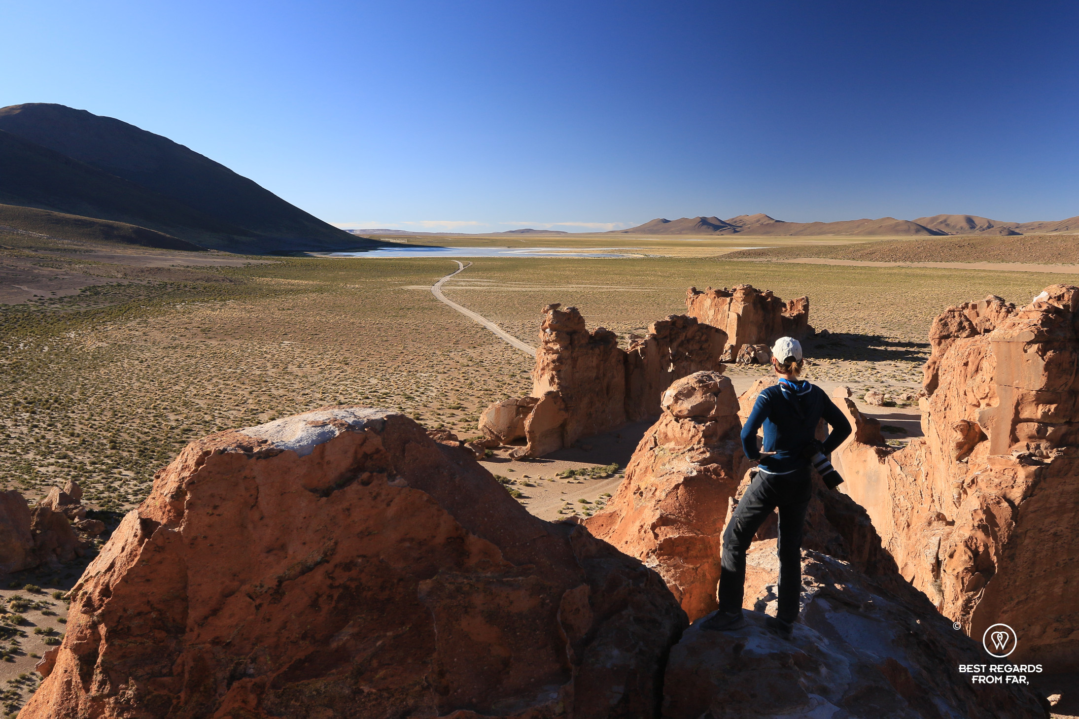
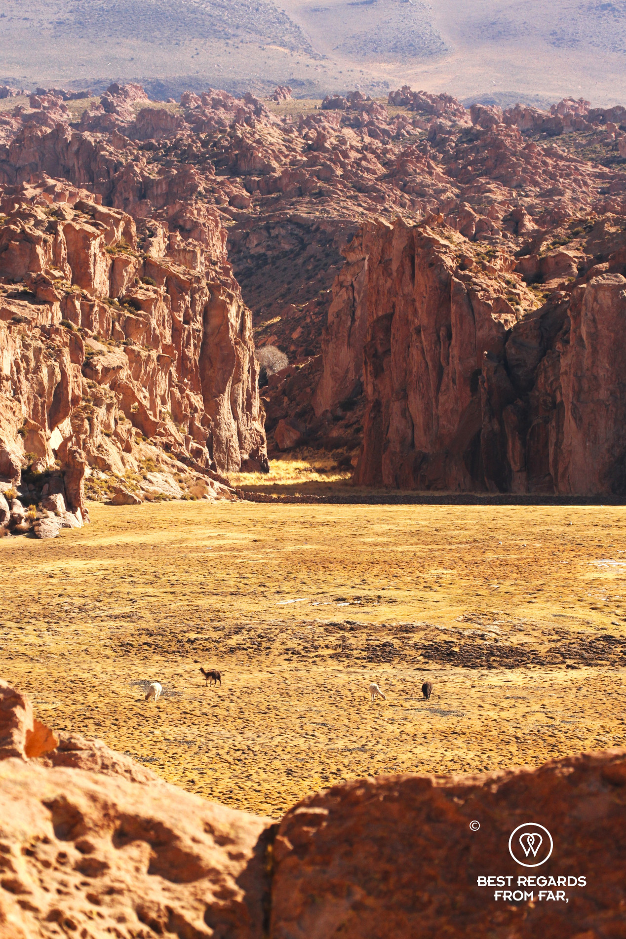
Anaconda Canyon: A Paradise for Birders
Heading south the landscape becomes even more desolate, with dried-out salt lakes and clay flats. On this high-altitude plateau, herds of llamas are crossing the road and quinoa fields dot the landscape. We cross paths with heavy trucks loaded with precious metals from the mine on their way to Uyuni. As we drive through this striking terrain, Alejandro yanks the wheel to take a dirt road. A quick stop to release the tire pressure allows us to continue smoothly along a sandy track to explore the Anaconda Canyon, formed by a long-gone glacier, water, and wind erosion. A flock of green parrots fly by when we take in the peculiar rock formations of the canyon. At its bottom, the water of the curvy river creates an important habitat for wildlife and birds and a green oasis along the river banks in the otherwise rusty-colored landscape.

Lunch with a View & Furry Friends
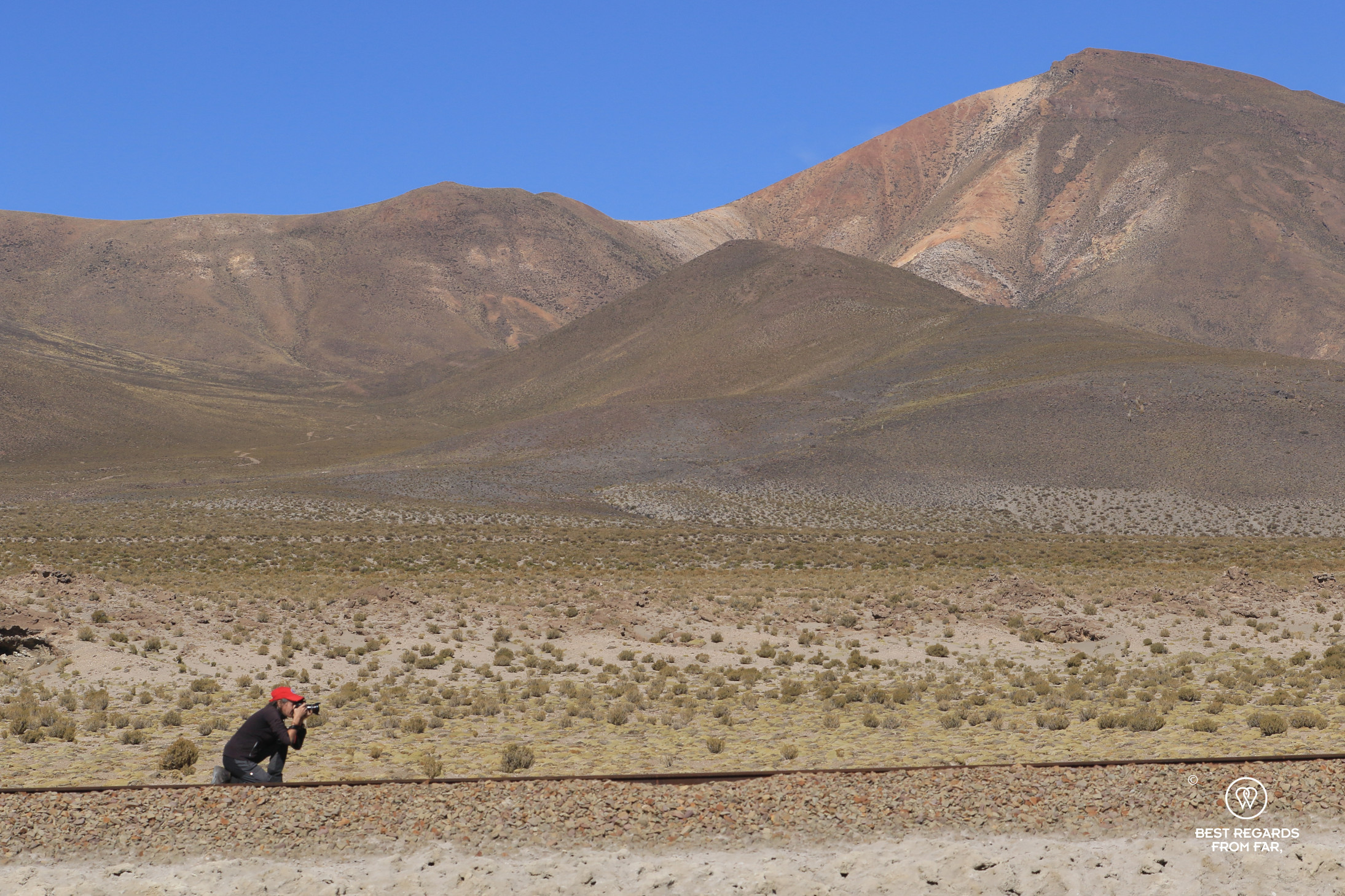
The Nissan Patrol slowly climbs up to an altitude over 4,000 meters (13,125ft) above sea level. While the air is cold, the solar radiation provides the perfect conditions for an outside lunch under the cloudless deep blue sky at the scenic Valley of the Rocks.
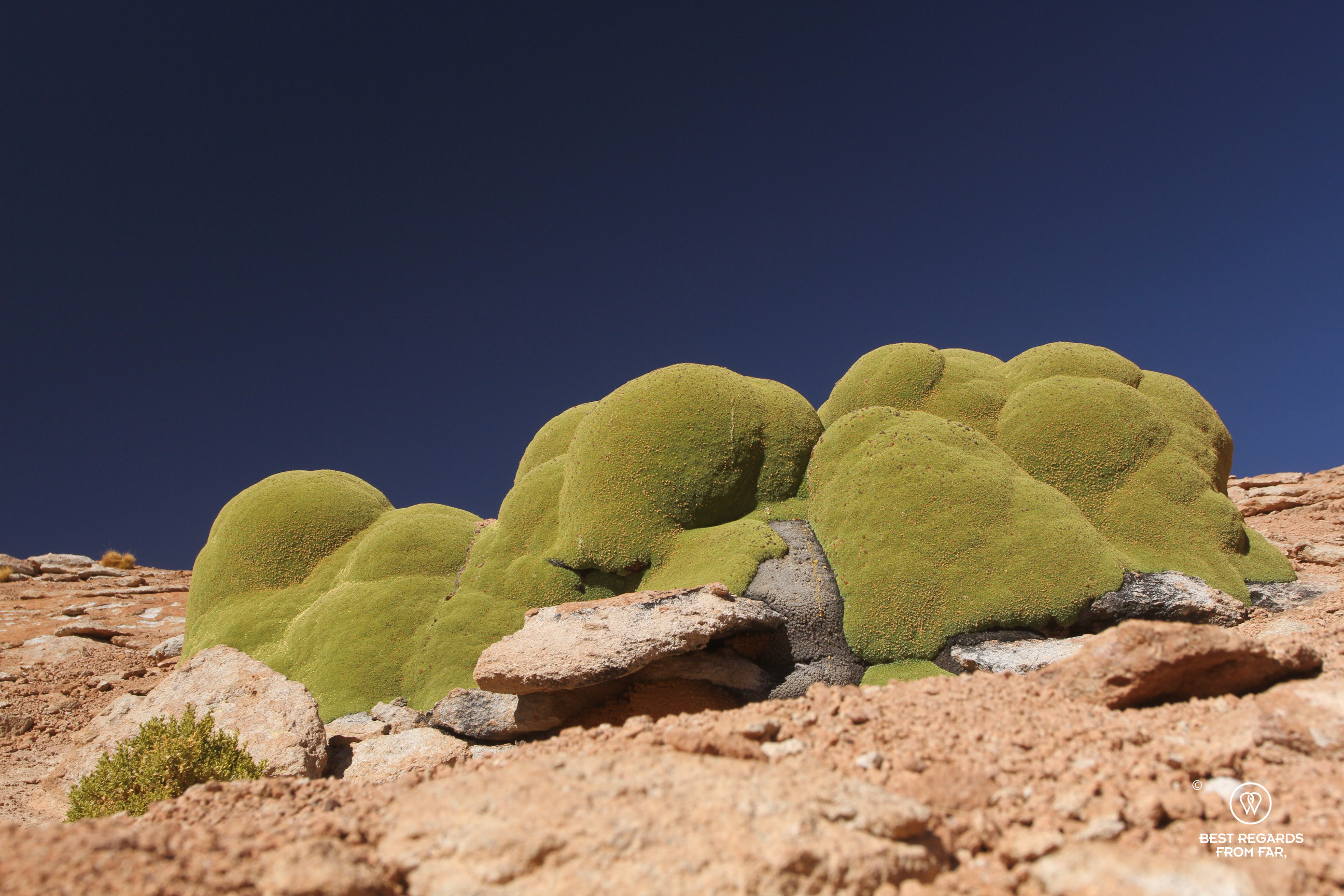
While for hours the landscape has been flat, the skyline is now broken by formations reminding us of the hoodoos of Bryce Canyon. While Alejandro pulls out an incredible aperitif and lunch, we study the rocks that we name at whim. A furry vizcacha—a rodent, cousin of the chinchilla—pops its head in the mineral landscape.


With a view on the dormant Unturuncu Volcano in the distance, we cheer to our commencing adventure, after donating a generous drop to the ground, a Bolivian tradition to honor Pachamama to thank Mother Earth.
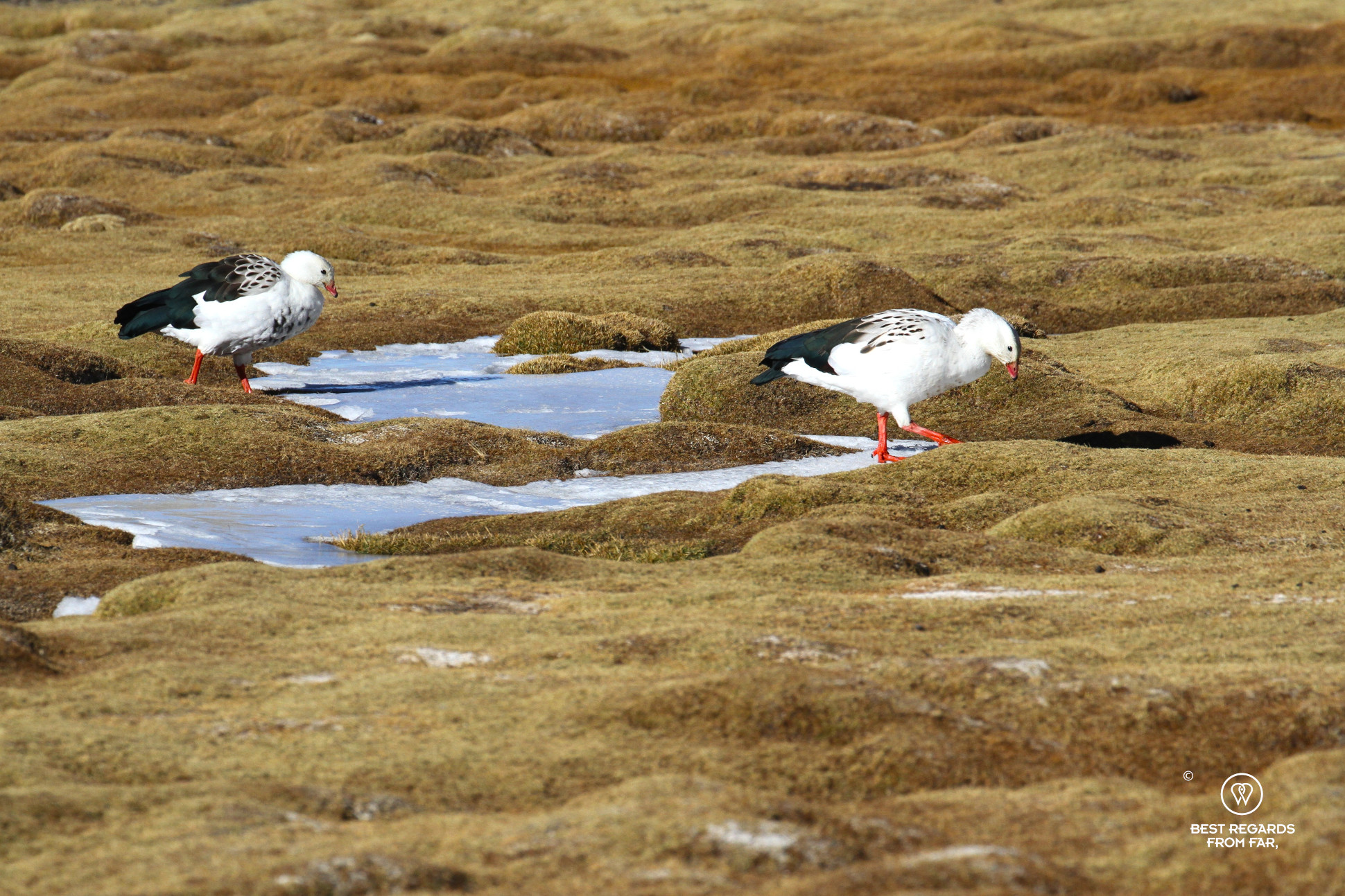
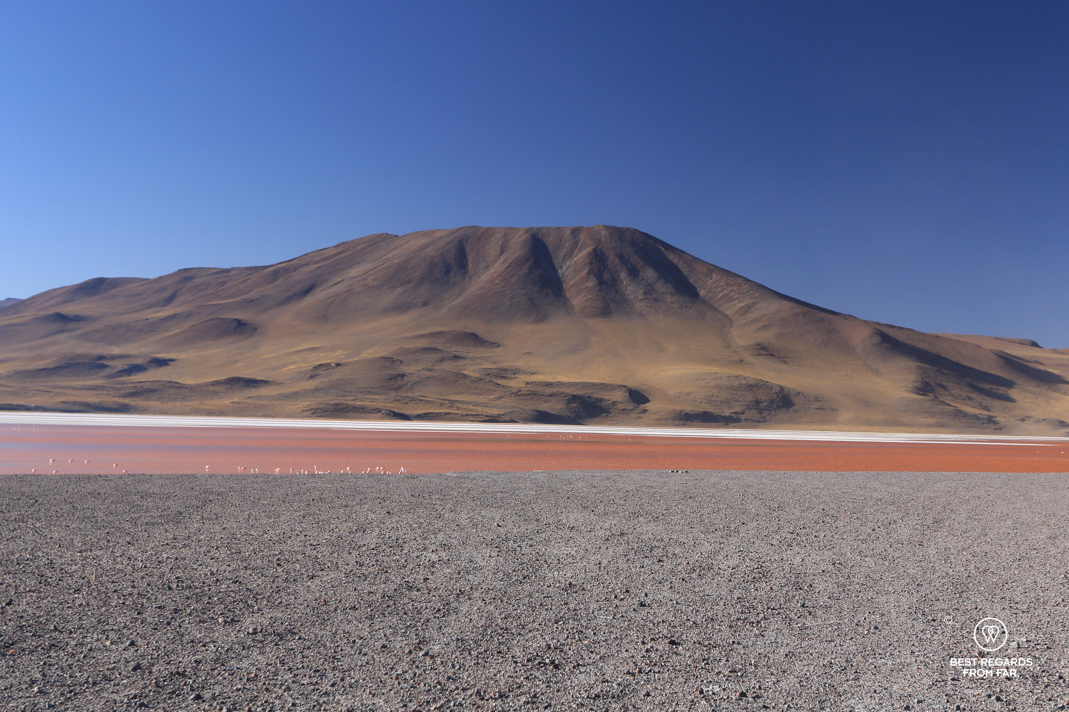
A Black Lake, Flamingos & Stupendous Views
As he makes progress fast on the sandy dirt tracks, Alejandro explains more about the geology of the landscape and the sulfur extractions that took place on the 5,500-meter-high (18,045ft) volcano. Suddenly, the flat volcanic landscape changes and makes way for a lake that is half-frozen surrounded by red rocks. A few llamas graze by small streams where the vegetation is the greenest. Male coots battle for territory, their loud shrieks echoing between the rocky walls. Stretching our legs and testing our bouldering skills, we explore the area of the quiet Laguna Negra. The contrast between the barren landscapes on which hardly any vegetation grows and the abundance of wildlife is striking. Contemplating the vast lands, more small lakes start dotting the area.


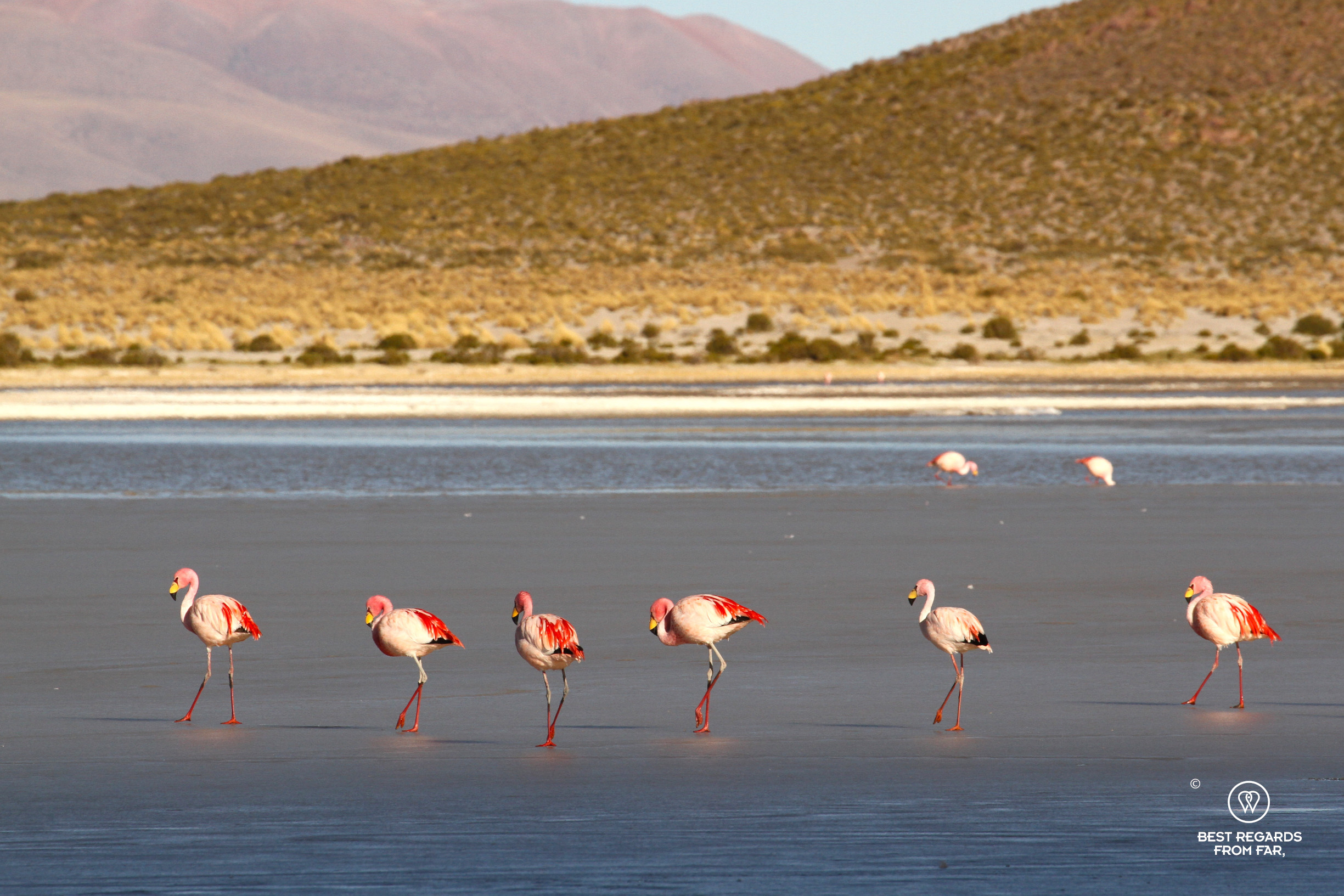
In the final hour before sunset, we pass Laguna Vinto, home to a large flock of James’s flamingos, one of the three flamingo species that can be seen in Bolivia. Their vibrant pink feathers glow in the fading sunlight as they forage head-down for small crustaceans to feed on.
Alpaca Wool, Yareta Fire & Soup!
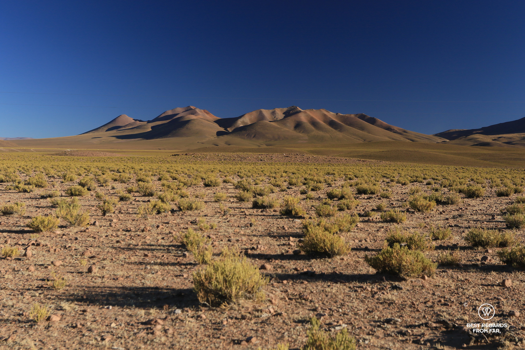
We make our way toward Quetena Chica a small hamlet, located in the Eduardo Avaroa Andean Fauna National Reserve. The rough landscape is ever-changing, with stunning views of valleys carved out by former glaciers, with majestic mountains, and small streams. Despite this being Bolivia’s most frequented park we feel like we are alone in the harsh settlement where the already cold temperature drops drastically as soon as the last sun rays disappear. The thick blankets made of alpaca wool, the small stove burning yareta—a slow-growing endemic moss of the Puna collected dead—, and the warm starchy soup become the highlights of our accommodation for the night!

***
Day 2
Eduardo Avaroa Andean Fauna National Reserve
Unlike the typical two-day-one-night Uyuni circuit, we have ventured off the beaten path and our bespoke itinerary has us discover the quieter, more remote corners of Bolivia’s Altiplano. Quiet is an understatement when we drive through the two hamlets of Quetena Chica and Quetena Grande at an altitude of 4,000 meters (13,123ft) above sea level.
Both villages were created before the park came into existence and now with the current regulations, the hamlets cannot expand. Strict regulations govern this park, strictly ruling out mining and farming. Only llama herding and the harvesting of medicinal plants like pupusa are allowed. The latter turns out to be the ailment to aid with altitude sickness. Despite acclimatizing before arriving in Uyuni, a few headaches pop up here and now, and nothing beats a pupusa infusion at night.

In recent years, small water treatment facilities have been introduced to prevent contamination of the lakes and protect local wildlife, such as flamingos. A portion of the park’s entrance fees is allocated to support these communities of former miners as part of a sustainable model that keeps the fragile environment intact.
Llama & Alpaca Herding
The llamas—lean, tough creatures—are perfectly adapted to this challenging and high-altitude environment. They weigh no more than 60 to 70 kilograms (132 to 154 lb.) due to the scarce vegetation that provides minimal nutrients. The llama herders here have begun crossbreeding them with alpacas to produce animals that are better suited to the harsh conditions. These crossbreeds, known as tampuli, have more resilient wool and are more resistant to the tough climate. Highly valued for their wool which is used to make textiles and clothes, they are cherished for their lean meat as well and provide an essential protein source for the local people. To protect their young ones from predators such as the Andean fox, llamas naturally gather in man-made enclosures for the night. Herders let them out in the morning when the temperatures rise. Marked with colorful wool in their ears, different herders can easily recognize their animals.


From Salty Lakes to the Desert of Dalí
Our adventure continues as we drive the jeep track and pass by many lakes, often salty and sometimes dotted with flamingos. Some are so shallow that they freeze over in the cold, with some, like Laguna Hedionda, remaining frozen year-round despite their high salt content that lowers the freezing point. Climate change is altering the ecosystem at an alarming rate: increasing evaporation rises the salt levels of the lakes, and threatens the delicate balance that sustains both plant and animal life.
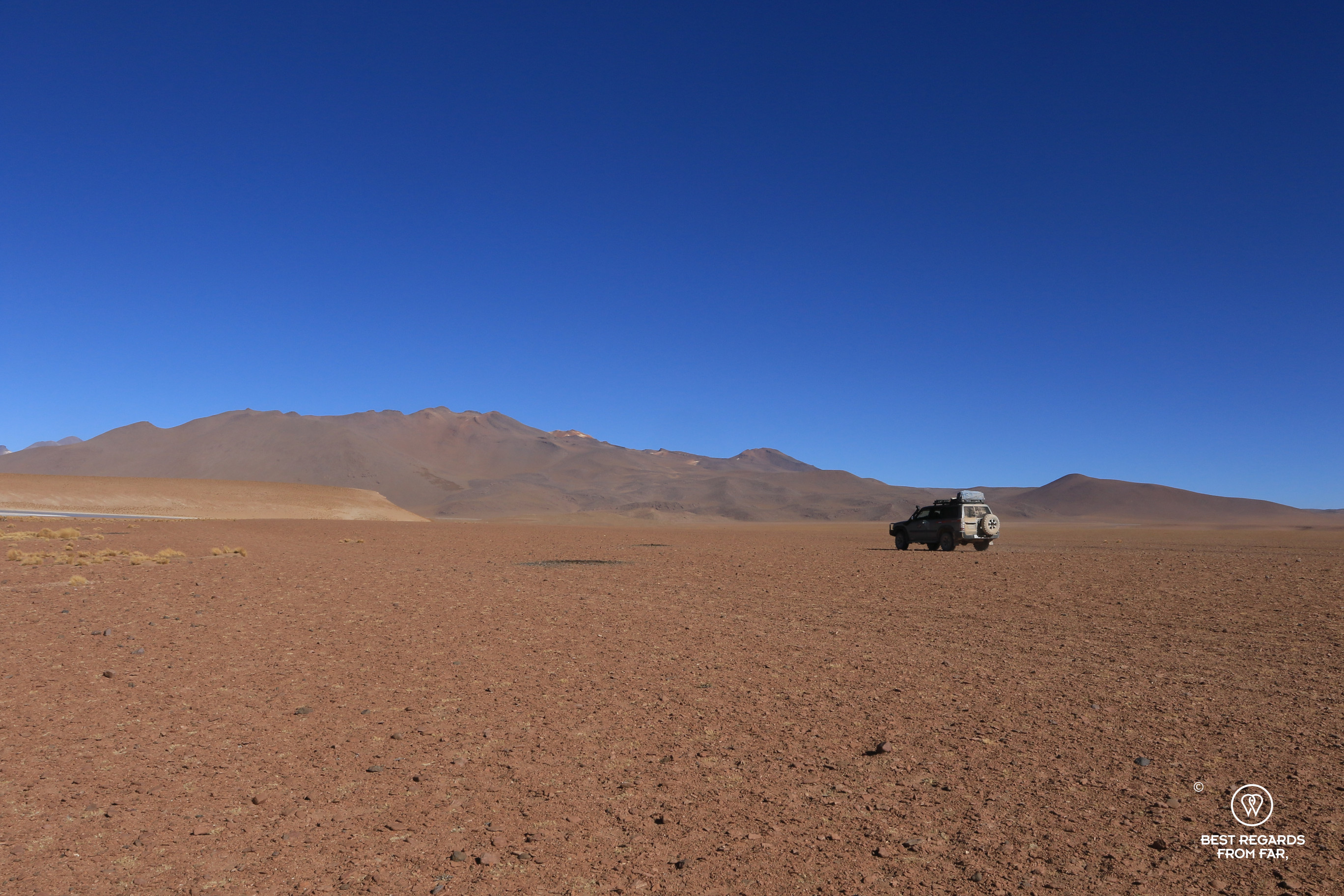

The lakes slowly make way for and even more barren valley where it is hard to imagine that any form of flora or fauna can thrive. We are driving through the Salvador Dalí Desert—or as locals call it Pampa Jara. The sandy landscape is decorated by some massive rocks which have been spat out by ancient volcanoes and are scattered randomly on the smooth ground. The scene resembles one of Dalí’s surrealist paintings that we try to capture despite our freezing hands that are hard to control on the camera shutter at this altitude of 4,750 meters (15,584ft).


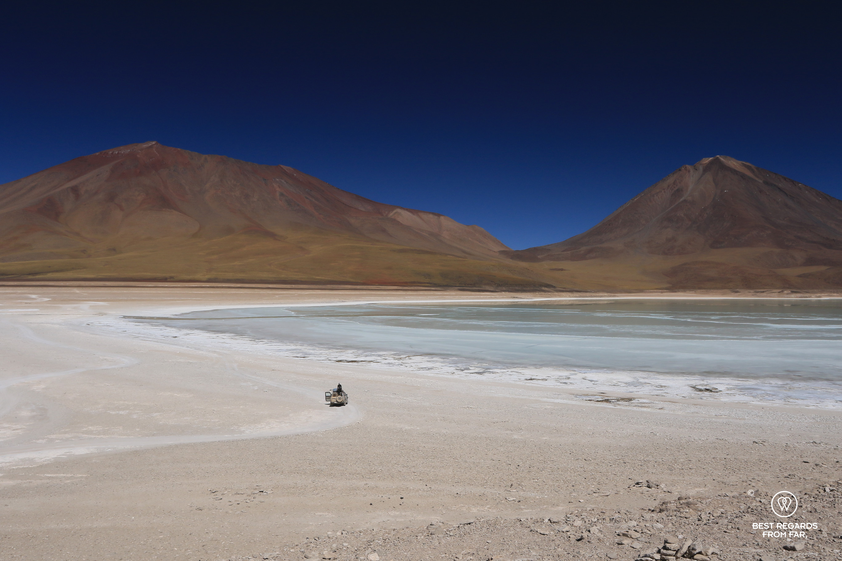
Termas de Polques Hot Springs: A Soak with a View
Moving away from Dalí’s surrealist scene, Alejandro maneuvers his 4×4 to a viewpoint to take in the surreal colors of Laguna Verde. The striking green colors of the lake are caused by a mix of minerals, including arsenic, and reflect the peak of the majestic Lincancambur Volcano, towering at 5,985 meters (19,640ft). Even though the volcano which sits on the border of Bolivia and Chile is a popular destination for mountaineers, we are not set-up for the multiday expedition to its summit.
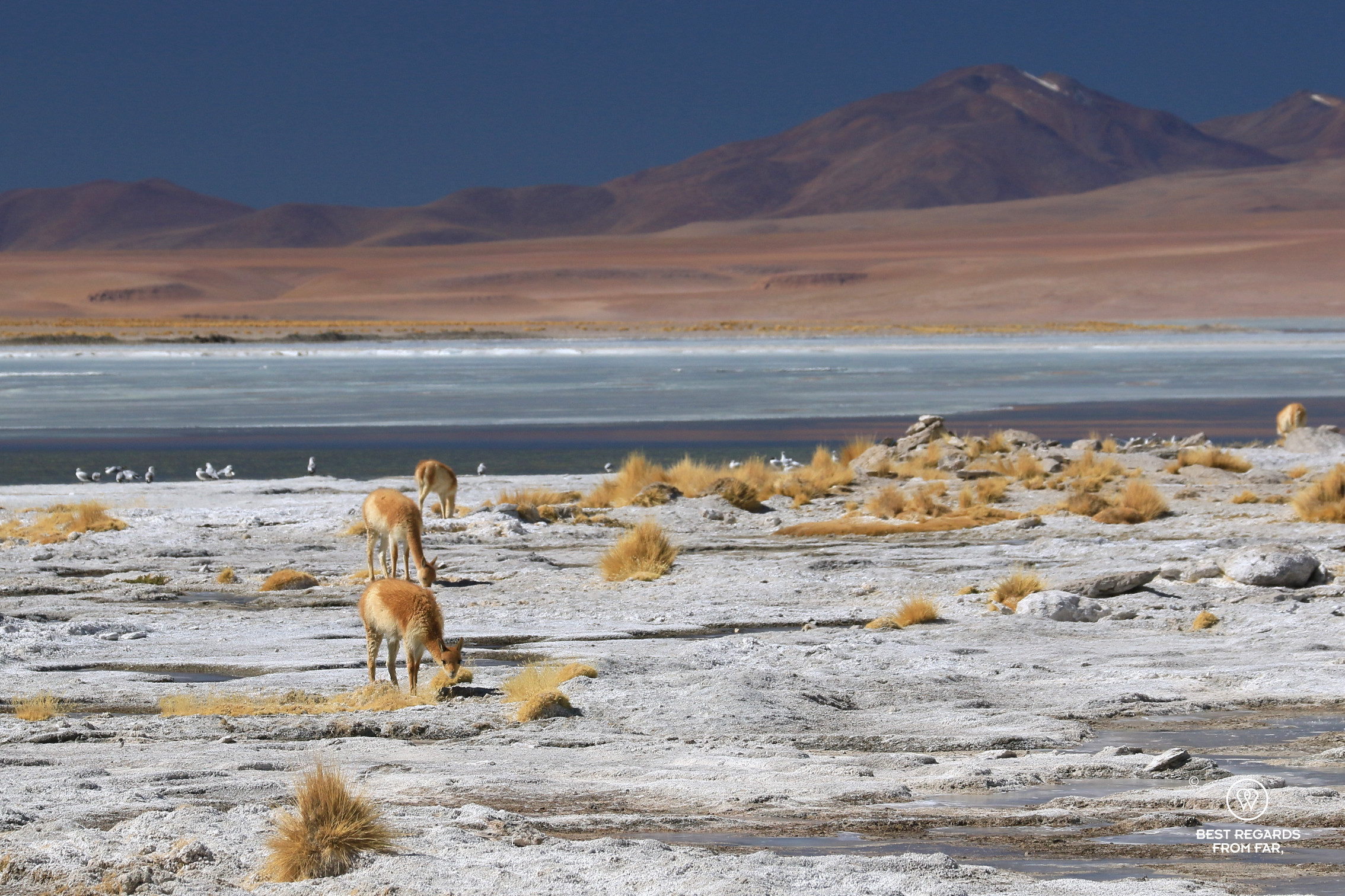
Instead, we relax in the healing waters of thePolques hot springs. Soaking in the naturally heated waters (35°C (95°F)) by underground volcanic activity we contemplate the wide views and observe a small herd of vicuñas—the only South American camelid that is non-domesticated and remains wild—nibbling on the vegetation bordering the warm waters.
The air is so dry that our skins dry off almost immediately after exiting the mineral-rich water. This after-lunch soak leaves us feeling refreshed and ready to reach new heights on our last adventure of the day.
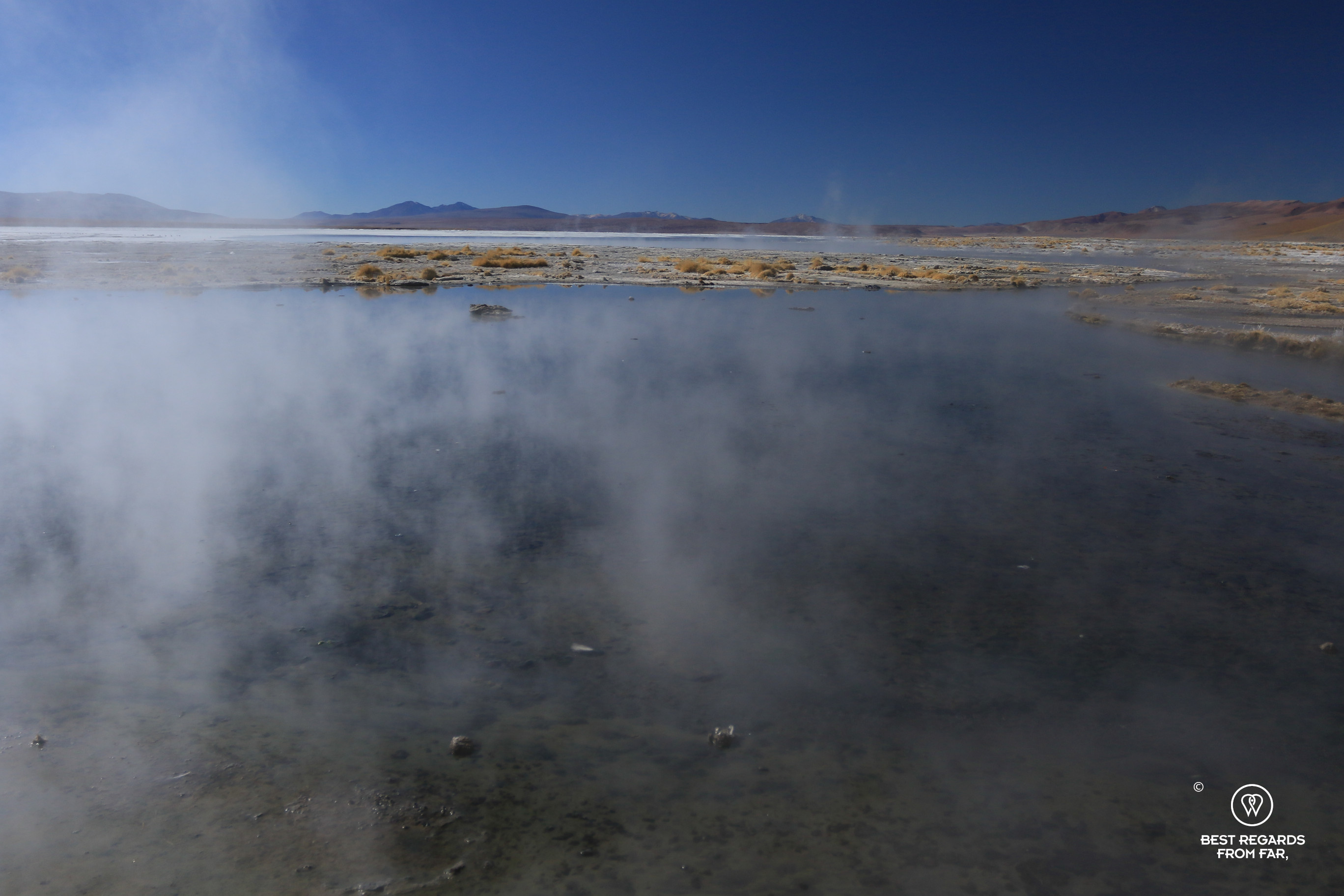
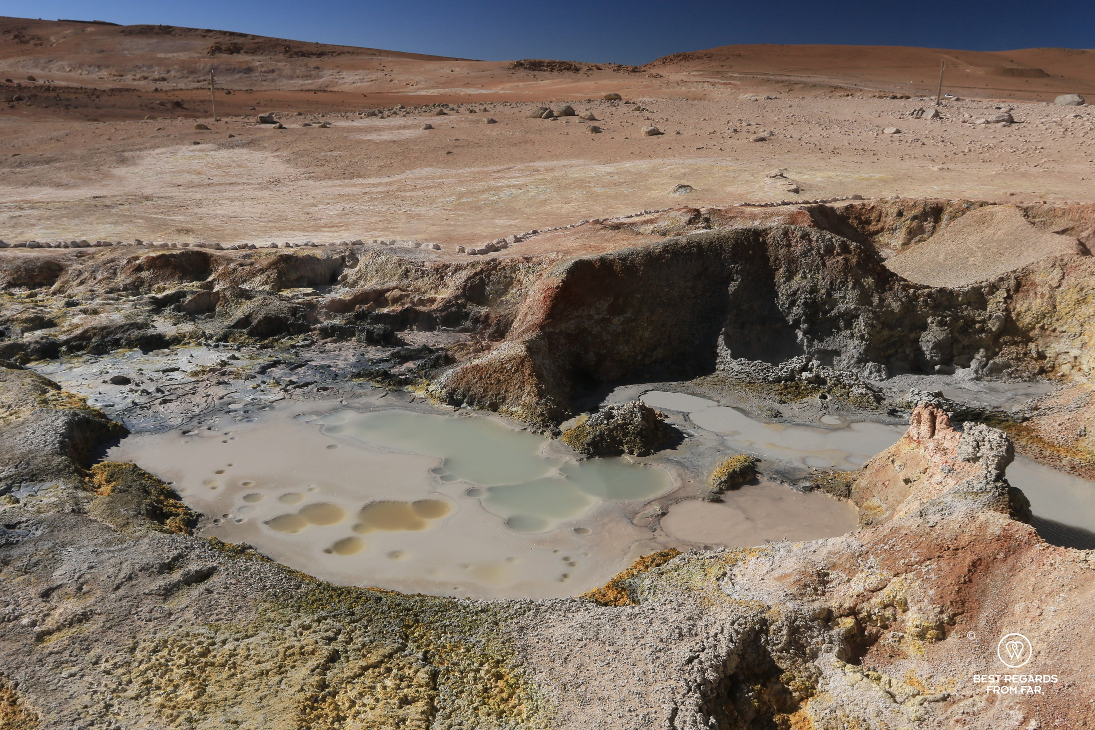
Sol de Mañana Geysers: Mud Pools & New Heights
As we hop into the car and discuss the captivating geology of the Altiplano, we ascend to 4,985 meters (16,355ft) above sea level, passing through dark volcanic terrain, yet another face of the region. Reaching theSol de Mañana Geysers, an area of clearly visible volcanic activity which stretches over one square kilometer (247 acres), we take a walk amongst boiling mud pits, avoiding the burning hot mud that is flying around. We slalom among fumaroles spewing hot vapor at temperatures of up to 220°C (428°F). The unique scene is a reminder of the powerful forces beneath the surface of this remote land and the last we take in for today.

***
Day 3
Laguna Colorada where Pink Water Makes Pink Flamingos
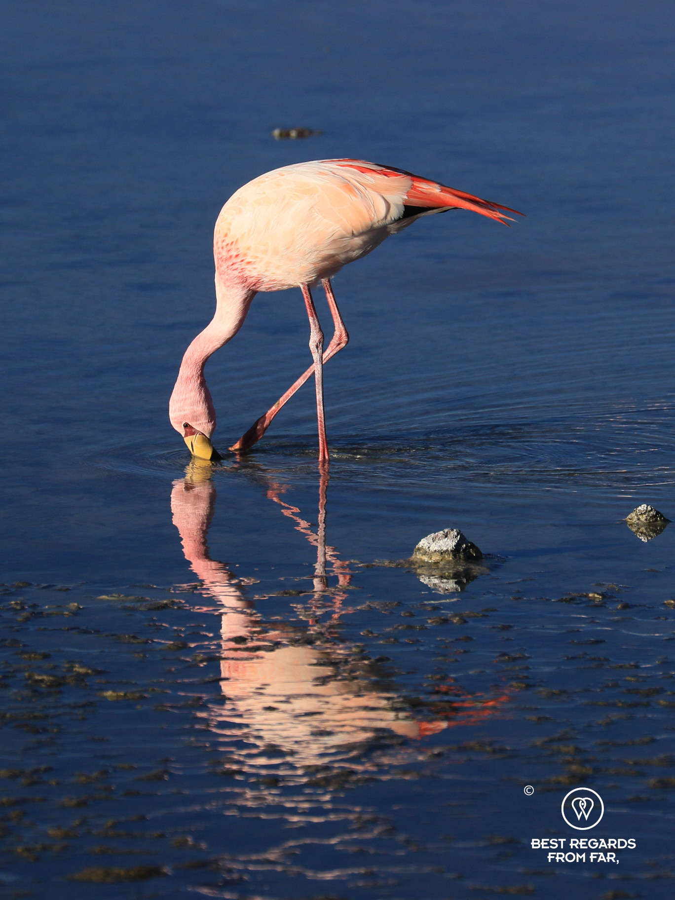
As we approach Laguna Colorada at the doorstep of our accommodation in the very early morning, the first thing that strikes us is the frozen edges of the pink lake, framed by vibrant grasses growing in half circles—proof of nature’s way of adapting to these harsh conditions. The lake’s distinctive pink hue is no accident. It’s caused by Dunaliella salina, a micro-algae that thrives in the high-altitude saline waters. This phototrophic microorganism accumulates beta-carotene to protect itself from intense solar radiation, giving the lake its vibrant pink color.


Flamingos flock here by the tens of thousands, feasting on the algae and micro-crustaceans that feed on it, turning both the shrimps and the flamingos into a beautiful shade of pink. In September and October, up to 45,000 flamingos can be found nesting on the borax-encrusted shores, their white eggs perfectly camouflaged in the salty terrain.
For now, we observe a smaller amount of foraging James’s flamingos, endemic to the high Andean plateaus while the Chilean flamingos and the rare Andean flamingos remain hidden. These migrating species will be back soon, and only the few that are too weak to attempt the long journey stick around.


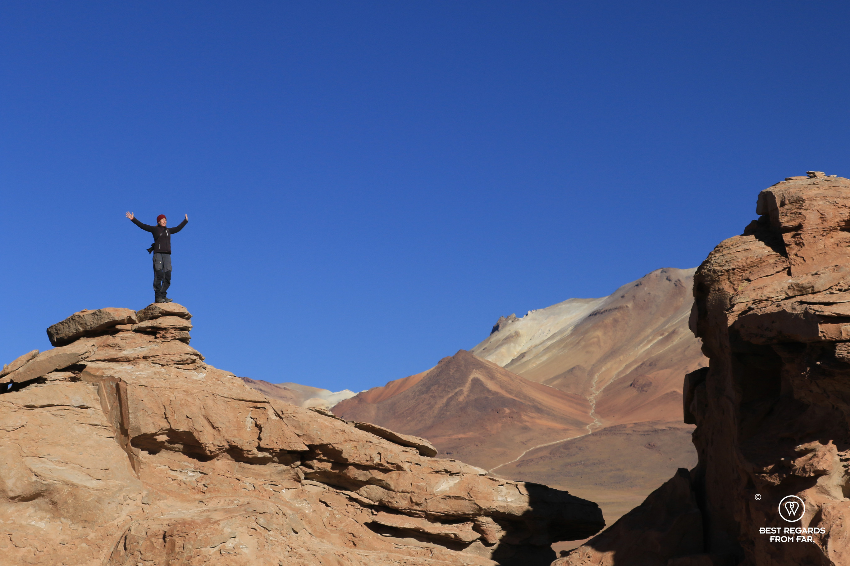
Desert Winds: Frozen Stone Trees
Driving further into the Desert of Sololi at 4,500 meters (14,763ft) above sea level, the effects of the wind are reflected into the stone carvings. Surreal shapes, even for Dalí, surface in the middle of the desert: the Stone Tree is a unique rock formation sculpted by volcanic eruptions and constant erosion.
If the morning is still peaceful and gives us the opportunity to scramble up other, less delicate formations, thermal winds usually pick up in the afternoon leading to perceived temperatures between -20 to -25°C (-4°F to -13°F), making this barren arid landscape not only beautiful but also haunting.


The Llama Caravan: A Glimpse into the Past
As Alejandro drives on towards the Salar de Uyuni, the landscape seems more fertile with higher humidity levels providing ideal conditions for quinoa crops. Our guide shares a memory from his childhood: the llama caravans. These caravans, once common in the region, carried salt blocks and dried llama meat, known as charque—still a local’s favorite in any traditional restaurant—to trade for fruits and vegetables. Each llama carried 30 to 35 kilograms (66 to 77 pounds) of goods, and the journey took up to a month, often beginning in the warmer months of March or April. Today, the caravans have largely disappeared, but the lean llama meat is becoming in demand and starts to even be exported.
Quinoa Farming: a Cash Crop for Exports
We continue our journey over theglacially-formed flatlands, passing pristine lakes like Lake Honda. Lunch awaits: quinoa, llama sausage, vegetables, and a chilled Uyuni beer, served by a local family. Quinoa, the golden crop of the Altiplano, is not just a meal but a livelihood here as we learn in a neighboring quinoa farm.
The farmer explains the delicate process of growing quinoa, a crop that requires a specific balance of soil and climate conditions at high altitude. Once harvested, the quinoa plant undergoes a meticulous process of drying, roasting, and washing before it is ready to eat.

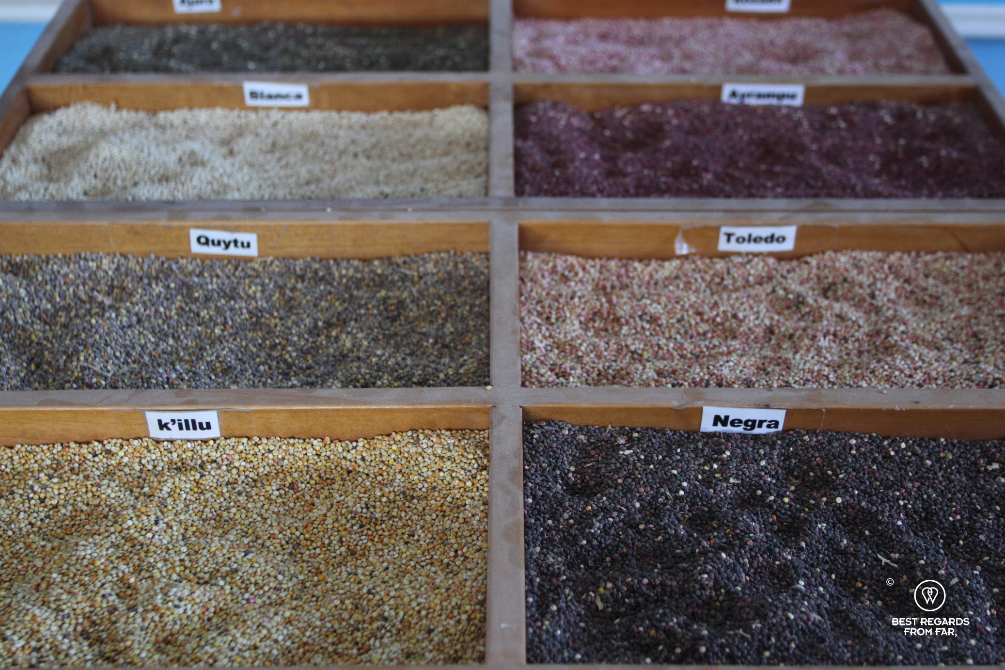
The superfood that is rooted in the Bolivian Altiplano in the region of Tiwanaku by Lake Titicaca contains 36 percent more proteins—covering all eight essential amino acids—and 73 percent more fibers than wheat, and high levels of iron, magnesium and zinc, as well as B vitamins riboflavin and folic acid.
As a flour or in soup, quinoa is a staple in Bolivia and Peru—healthy, nutrient-rich, and versatile. However, the increasing worldwide demand has led to such a significant price surge that a part of Bolivia’s population is no longer able to afford it, replacing the endemic quinoa by wheat-based imported pastas or rice—the beauty of globalization…
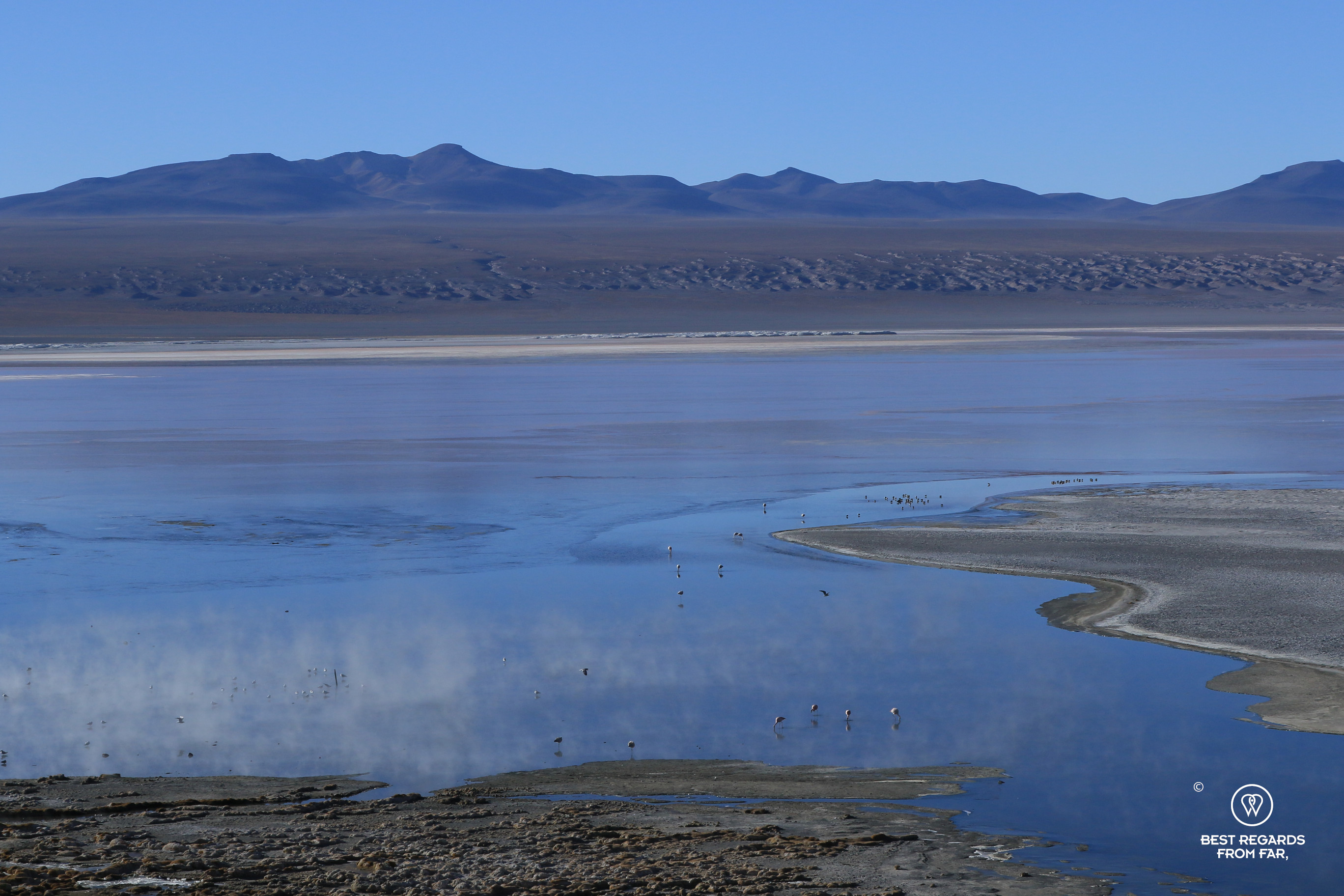
The Salt Flats & its Wealth of Minerals
The crossing of another clay salt flat for which 4×4 driving and navigation skills are definitely required, leads us to the massive Salar de Uyuni, world’s largest salt flat!
Covering an astonishing 10,582 square kilometers (4,089 square miles, or roughly the size of Lebanon), this once a gigantic lake has formed today’s salt flat over different stages of evaporation. Salt here can reach depths of up to 120 meters (393ft) even though on average it reaches depths between 3 to 10 meters (10 to 32ft).
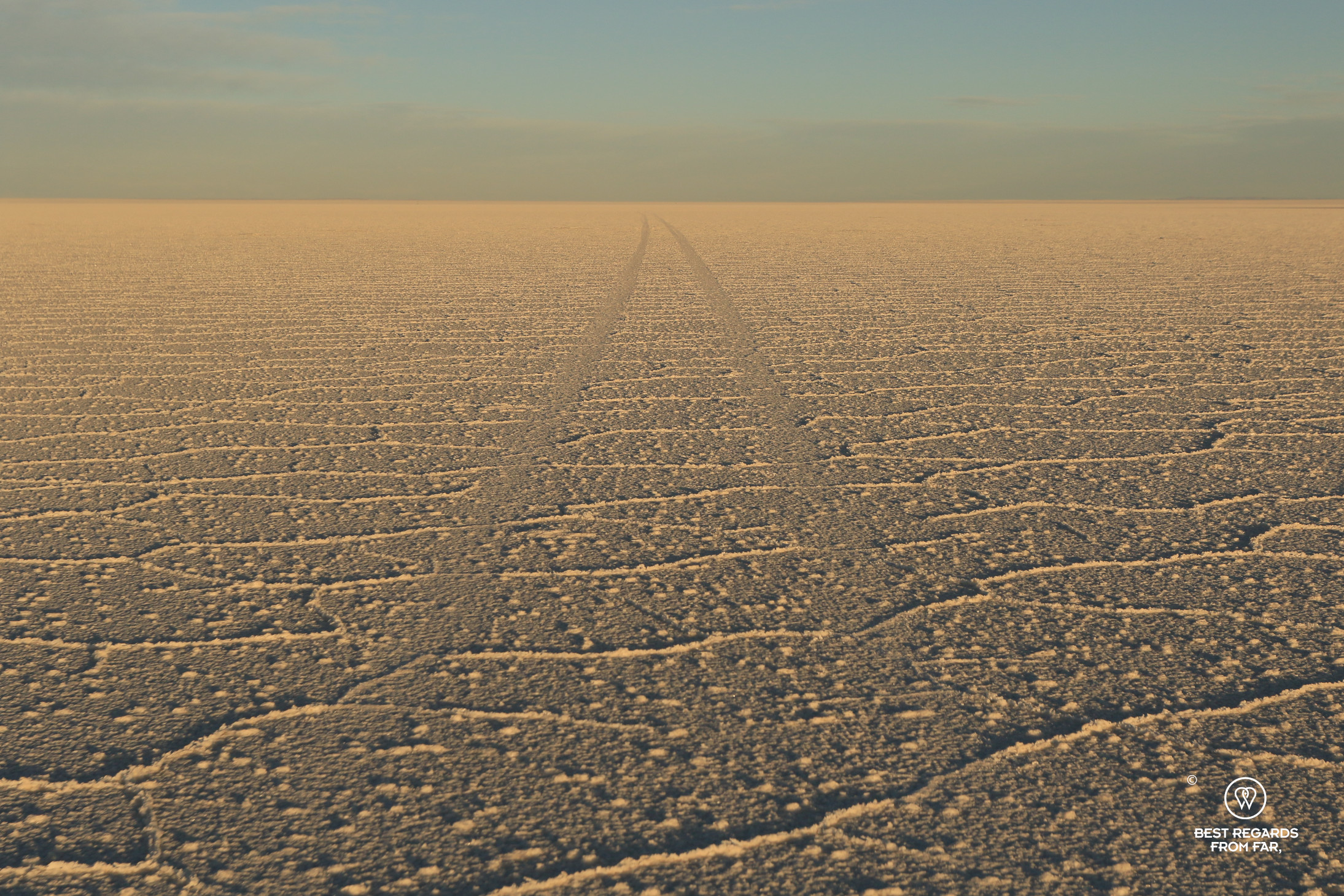
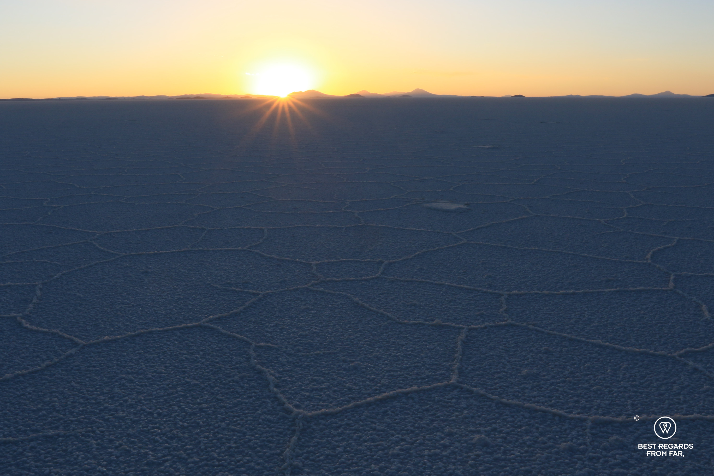

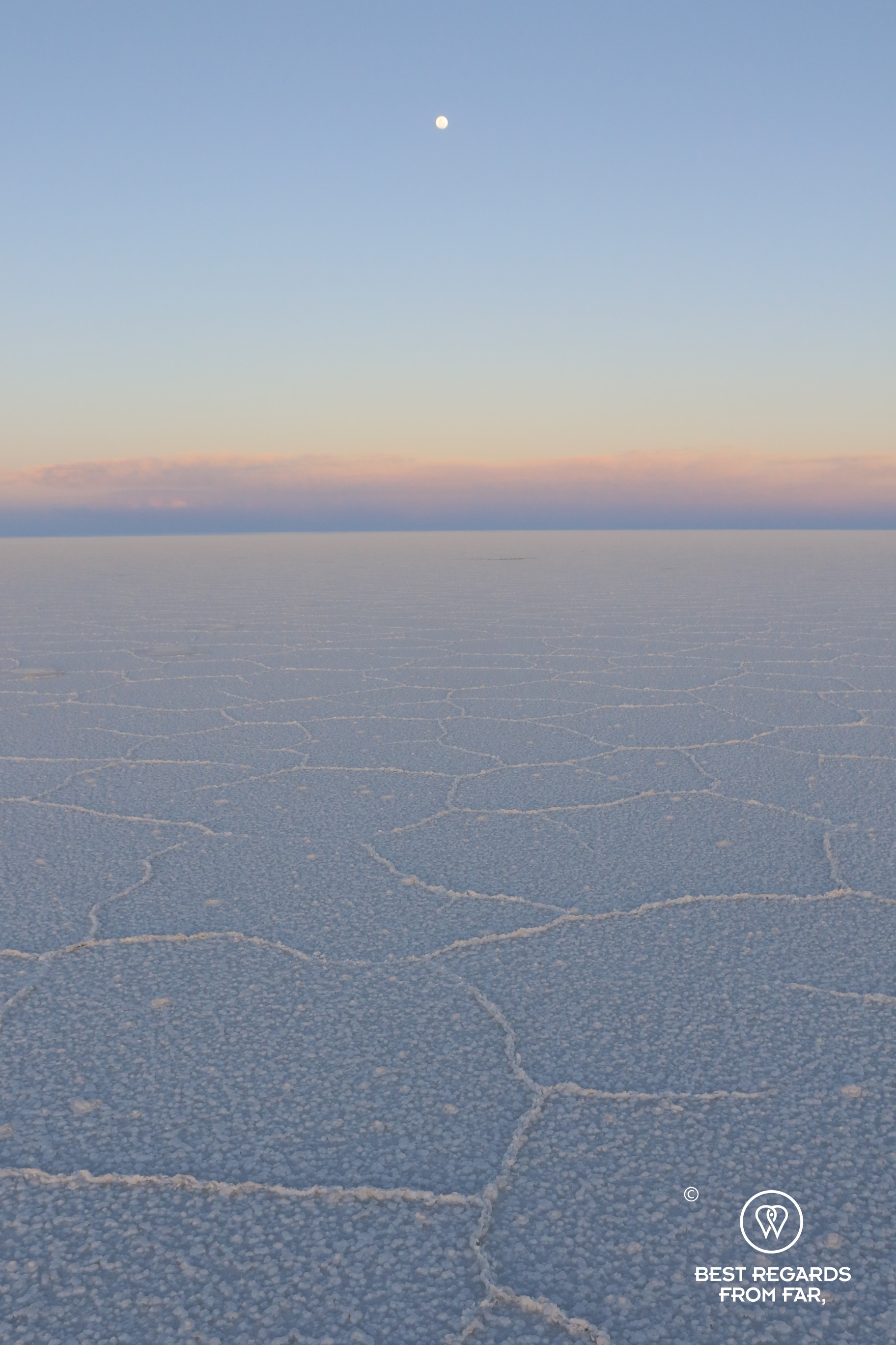
Before we know it, the wheels of the Nissan Patrol hit the crusty surface and we seem to be floating on an endless sea of white. At times, for kilometers, the surface of the flat resembles a puzzle of polygon patterns—a phenomenon observed in salt flats all around the globe. The salt pans are actually quite humid below their crust, as Alejandro is about to show us. As the crust is porous, the underground water seeps through and evaporates because of the high solar radiations. As it evaporates, its concentration of salt increases, also increasing the density of this thin layer of water that hence sinks as fresher water rises, similar to the convective loop of boiling water a pan. With this phenomenon repeating with neighboring cells pushing each other to not let any void in-between, honeycomb patterns are formed at the surface of the salt flat.
This vast expanse is not just a natural wonder with these interesting and surreal honeycomb-shaped structures but also a wealth of valuable minerals, including lithium, boron, potassium, and magnesium. In fact, the Salar is believed to contain around 10 million tons of salt, with 25,000 tons extracted each year for various uses, including salt production and lithium mining.


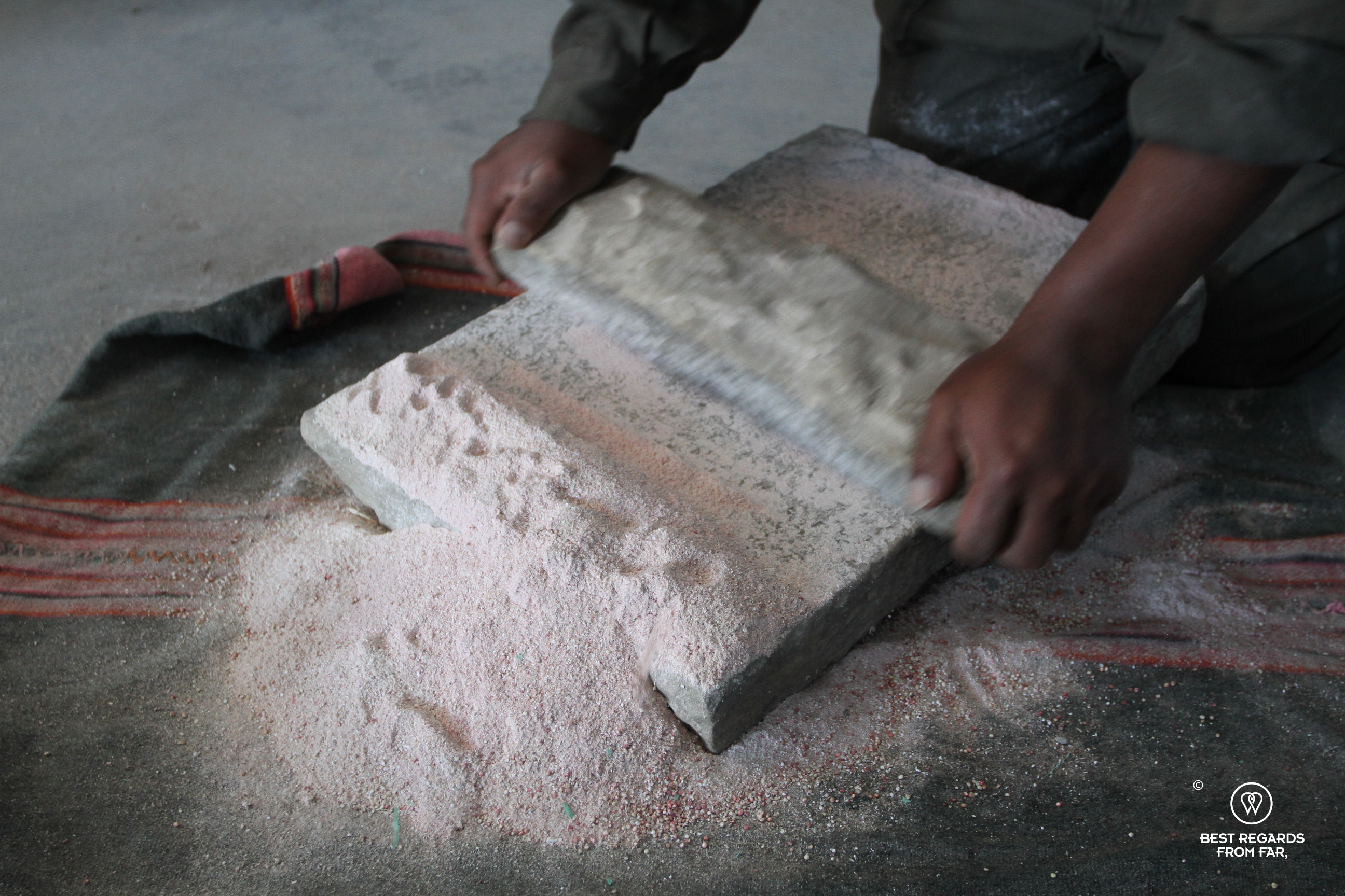
The Salt Labyrinth & the Birth of a Legend
A wall of salt sticks out on the otherwise flat surface; it is aSalt Labyrinth, a new installation constructed by a local family. 40,000 salt blocks extracted from the Salar were assembled to create a life-size maze from which it is tricky to escape!
As we gaze out over this remarkable landscape, Alejandro shares a local legend: the Salar de Tunupa, as locals call it, is said to have been created by an Inca princess, who, after fleeing her father’s wrath, gave birth to a son who died due to the harsh climate. Heartbroken, she turned her tears into salt, and her body became the volcano that watches over the region.
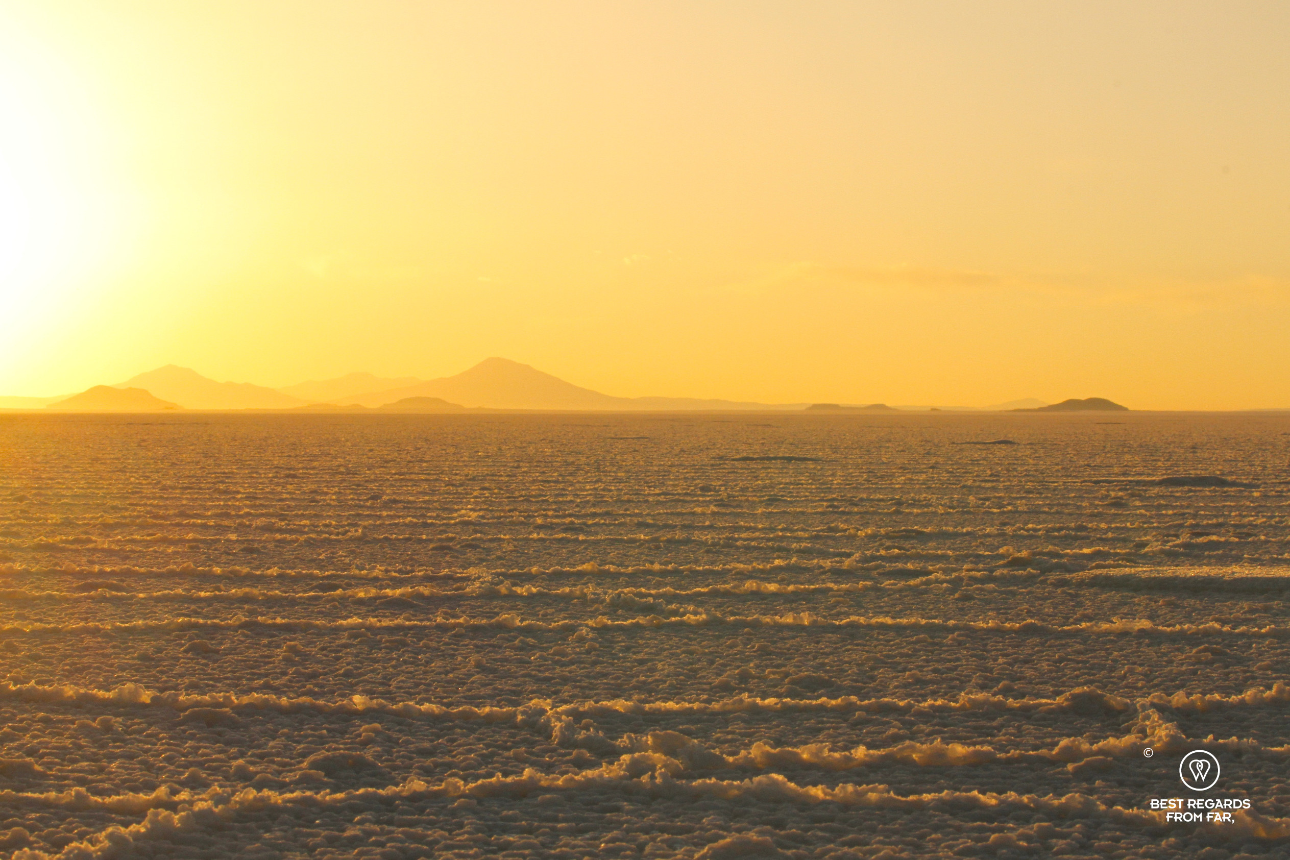
We take in the sunset over the salt flats before spending the night with Tunupa watching out for us, at the foot of the volcano, and soundly fall asleep before an early wake up to take in the sunrise over this mind boggling landscape.


***
Day 4
An Exquisite Sunrise over the Salt Flat
Slightly anxious about the cold that we are about to brave, we meet Alejandro for a short drive to observe the sunrise over the salt flat. The Salar de Uyuni stretches endlessly, tainted in a blue hue at this dawn of day.
As soon as the welcoming sunrays reach over the horizon a stunning rainbow of colors dances on the slopes of Tunupa Volcano, evoking memories of the vibrant Palcoyo mountains in bordering Peru. As the sun rises, the foot of the volcano comes alive with flamingos elegantly wading through the water and vicuñas grazing in the distance. The surrounding quinoa fields are divided by ancient drystone walls, creating a patchwork on the steep and fertile slopes of the volcano.


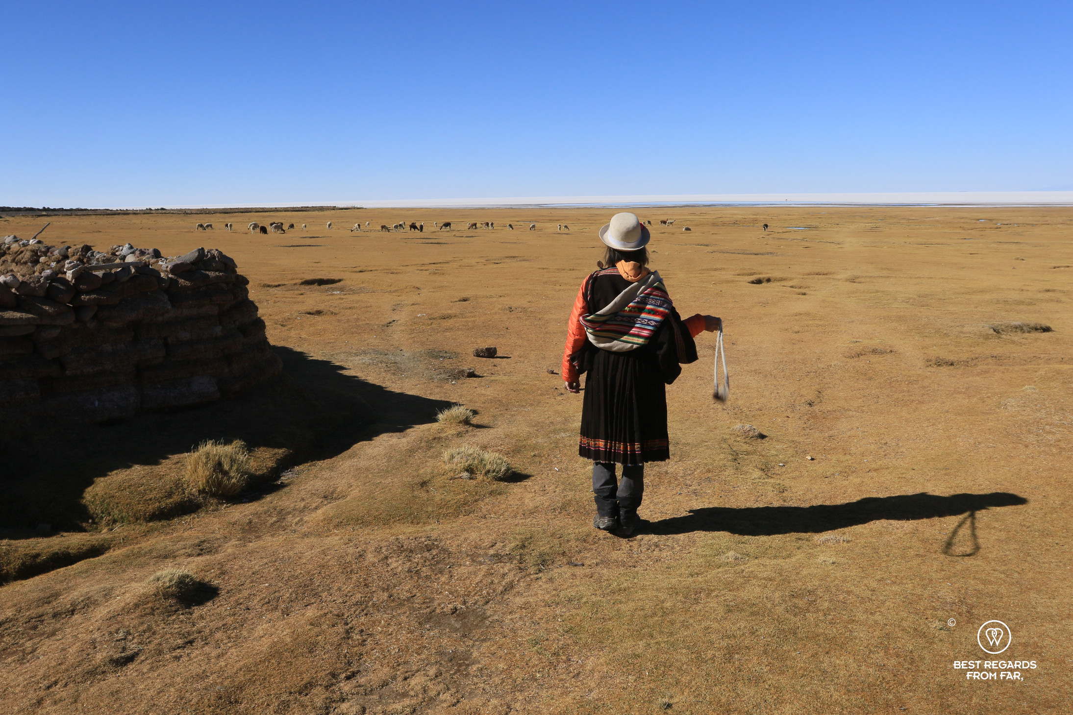
Traditional Llama Herding
In the small settlement of Tahua on the banks of the Salar, a local farmer herding about five dozens of llamas has us share a small slice of her life. She lets out her camelids from of hundreds of years old stone-walled enclosures was built by her ancestors who first started llama herding many centuries ago.
The villagers, dressed in hand-woven llama wool clothing complete with woolen hats, herd their animals with woolen slingshots—more difficult to use than initially thought! With 1,400 llamas for just 300 people, this community relies heavily on these gentle creatures for their livelihood.
Incahuasi Island: Cacti, Inca Ruins & a Surreal Lunch
The Salar de Uyuni is home to various islands of which Incahuasi attracts most visitors. Literally meaning “Inca House” in Quechua referring to the pre-Columbian Inca ruins on the island, Incahuasi is one of the most sacred spots of the region where every August 1st important rituals are performed to honor Pachamama, Mother Earth. We make our way to its peak amongst the large cacti and take in the view on the salt flat. The site breathes tranquility and majesty. From its high point, the approaching 4×4 in the distance resemble ridiculously small toys.
Midday calls for a unique experience: a traditional boudin de carne lunch, set up right in the middle of the salt flats. Surrounded by nothing but the endless white horizon, and Incahuasi on one side, we sit down to enjoy a meal that feels as surreal as the landscape around us. The solar radiation and its reflection on the bright white salt flat make us feel comfortably warm despite the high altitude and close to freezing temperatures.

Eye to Eye with the Eyes of the Salt Flats
As Alejandro packs the gear, we crawl on our bellies over the crusty salt to take some fun perspective photographs in one of the most remote areas of the salt flat.

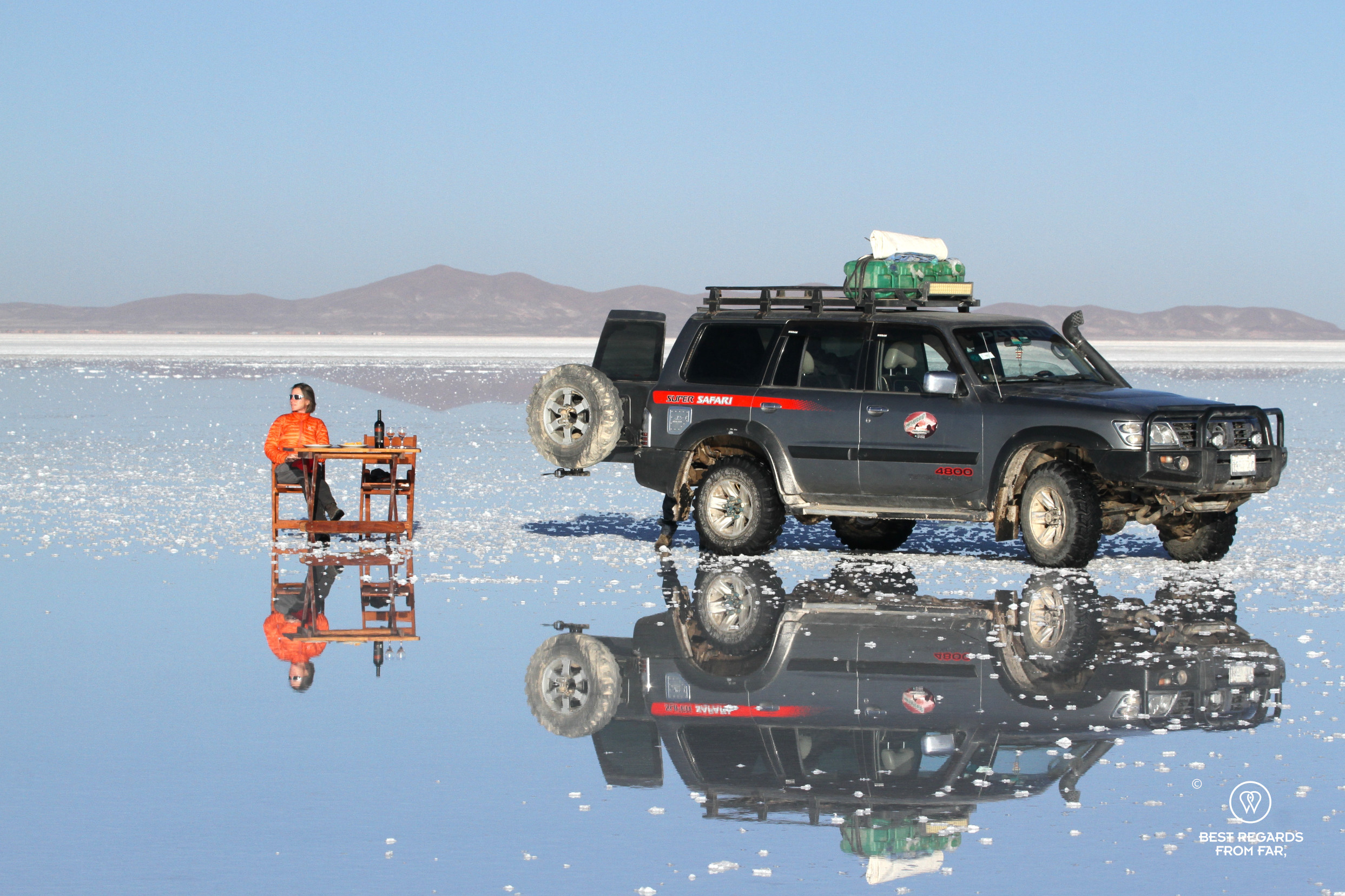
While we are heading to Alejandro’s favorite wet sunset spot, he suddenly pulls over the car. We are stunned to see crystal-clear water emerging from a cavity right beneath our feet. Alejandro has found one of the rare circular water holes that seem to emerge from the salt crust like the eyes of a hidden creature. Referred to as “the eyes of the salt flats” they reveal the presence of subterranean rivers that flow underneath the Uyuni Salt Flat: all the more reason to be very alert when driving as it is easy to sink a wheel in one of these when crossing the seemingly solid surface!


The Last Sundowner under the Rising Full Moon
Although it is July and most of the water from the rainy season—which runs from December to April—has evaporated, there is still a small area where water covers the surface of the salt flat. This unique feature draws tourists to capture selfies and photos, playing with the surreal landscape and perfect reflections.
As our adventure through the remote corners of Bolivia’s Altiplano is about to come to an end, we reflect on the incredible landscapes, fascinating flora and fauna and rich Andean cultures. The Salar de Uyuni, while awe-inspiring itself, has just been the conclusion of a much larger, more profound journey through one of the world’s most unique regions that remain unknown to most visitors. Grateful for all the beauty we have seen over the past intense four days, we cheer with a glass of red Bolivian wine to this adventure of a lifetime while the sun slowly sets below the horizon.


As we thought the Salar had revealed all its secrets to us, a full moon rises behind us for yet another surreal scene that could have taken place on Crait, the planet of Star Wars’ The Last Jedi—which scenes were shot here. The vast salt flat bathes in warm hues of orange once more, while the sky behind us shifts into shades of purple and pink. One last magic moment!
***
We head back to Uyuni, camera cards full with thousands of photographs, and our memories rich with such a variety of adventures in a rather short time-span. While the Salar is an absolutely unique experience, it is hard for both of us to decide which landscape resonated the most with us, and the days preceding the arrival to the salt flats are nothing short of stunning natural beauty and shear adventure.
Travel tips:
- To explore the Salar de Uyuni, Thaki Voyage can customize any trip to your specific needs. Highly reliable and professional, with a great attention to details, Thaki Voyage crafts unique trips and ensures tasty, varied, and well-balanced meals using exclusively Bolivian products and catering to all types of food restrictions. For this adventure of a lifetime, don’t hesitate and only go with the best!
- To visit, favor October as the flamingos are back to breed and you may be lucky to observe a mating dance, the climate is a bit less cold, and most of the tourists are gone.
- Various accommodation options are available from very basic to luxurious—the latter options are located outside the reserve, adding driving time.
- Be ready for the altitude and set up your trip smartly to acclimatize prior to the Salar as the exploration takes you close to 5,000 meters (16,404ft) above sea level. Thaki Voyage can help craft the perfect itinerary to take this into account.
- Check out our interactive map for more in the area (black pins lead to an article):
For more in Bolivia:


Awesome article! I did not know about the cross breeding of llamas and alpacas or the flamingos. Very cool!Sent from my iPhone
Very happy you enjoyed it! Thanks for your read & comment.