Article updated on 18 January, 2024
Text & photograhs: Claire Lessiau & Marcella van Alphen
“Whose idea was this, again?” I barely hear the question over the loud flapping of the freezing cold 200km/h wind against the sleeping bag I am tucked into, fully dressed in the multiple layers of the warmest clothes I have. Indeed, after the life-threatening Daikiretto in the Japanese Alps, the Grand Traverse of the Daisetzusan in Hokkaido, the mosquito-infested 5-day Mirador trek, and playing the Robinson’s on a lost and remote island, etc, I have to admit this was again one of my ideas… It didn’t sound that bad at first: a 7-kilometer hike up the Acatenango volcano to observe the active Fuego volcano at sunrise.
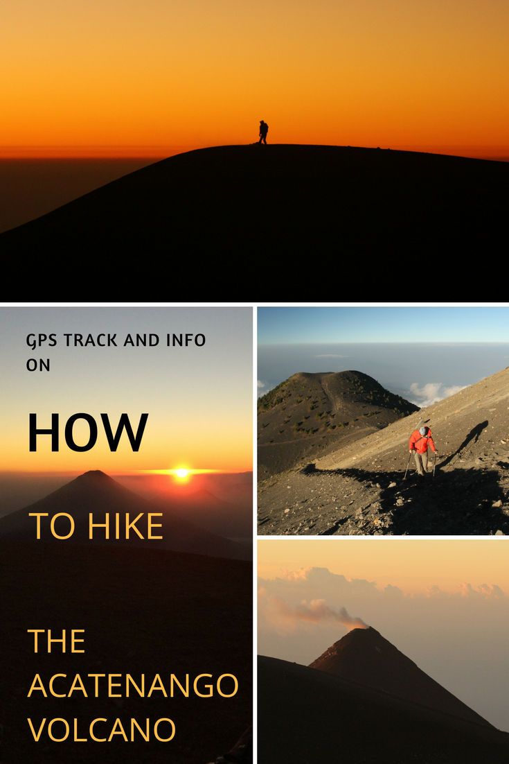
Pin it for later!
It all started yesterday morning in Antigua, meeting the two police officers that were to come along to ensure our safety. We jumped into the back of the police pick-up truck to be dropped off 40 minutes later at the foot of the Acatenango, close to the village of La Soledad.
This is to say, the actual hiking part. The organizational part started two days prior, asking the INGUAT PROATUR (tourist assistance of the Guatemalan tourism institute) for the support of the touristic police whose role is to reassure travelers and guarantee their security in Guatemala. After a warm welcome, I filled out an Internet form in Spanish explaining our itinerary and received a positive reply only an hour later along with instructions to meet our escort. A few more details like double checking with the local office on when to meet, buying food for the group, and packing as light and warm as possible were also smoothly taken care of.
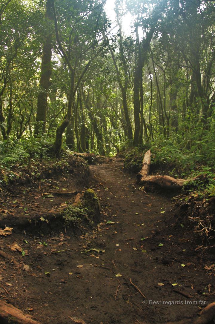
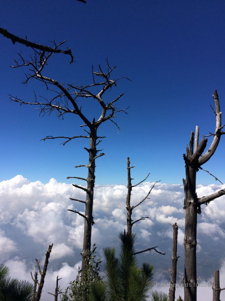
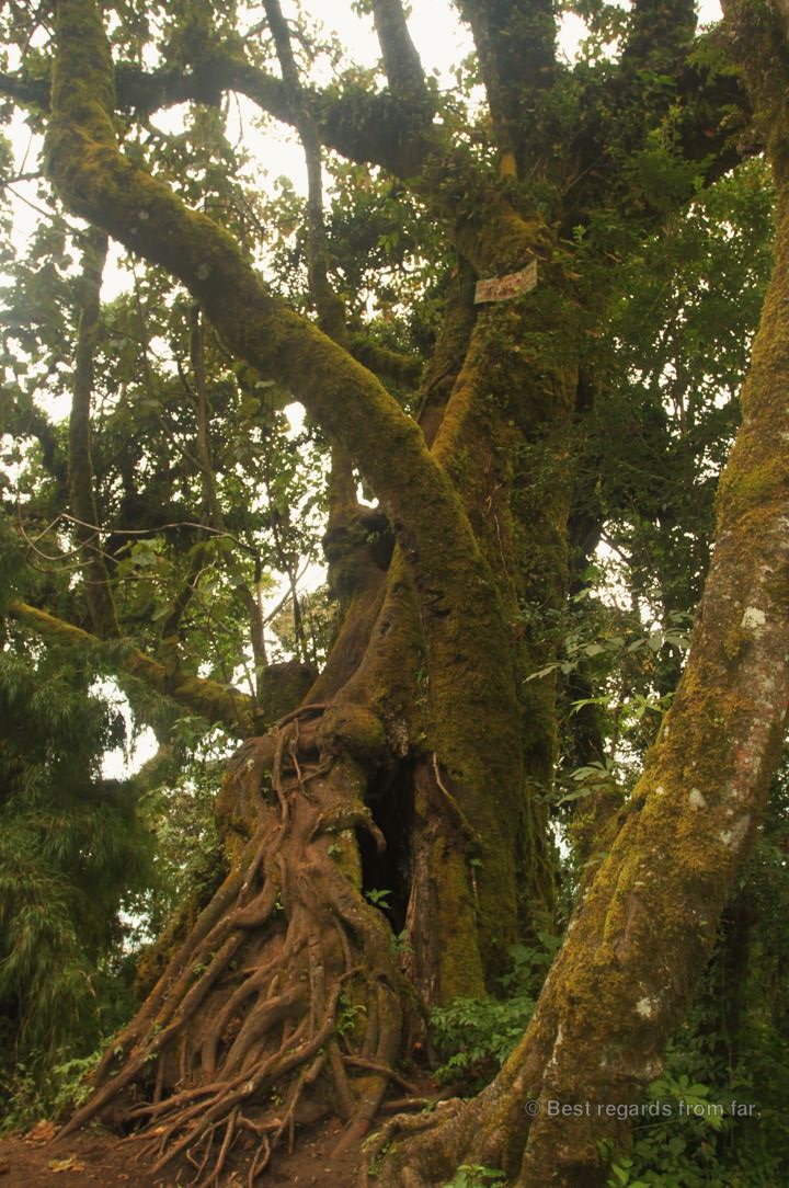
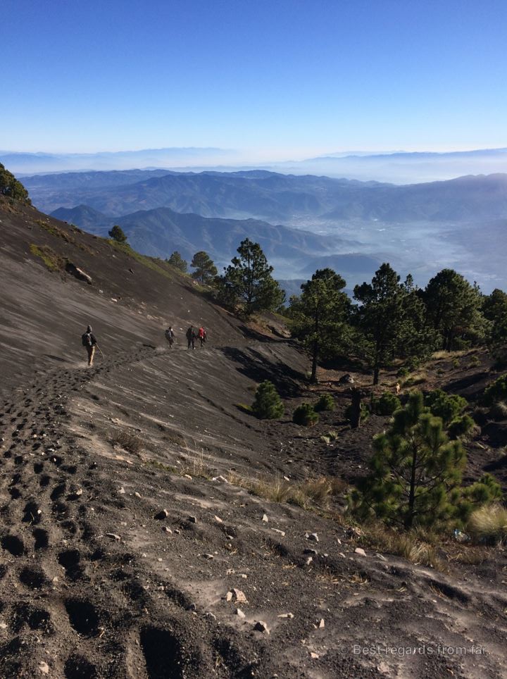
At the foot of the Acatenango, looking at its steep slopes, we realized that the trail was going pretty much straight up: the short 7-kilometer hike presents a positive elevation of more than 1650 meters to reach the summit at 3976 meters. If the first part through farming plots with the dramatic back drop of the volcano went up gently, the dusty and powdery soil didn’t facilitate our progression. With our heavy back packs and blessed walking sticks, we made it up through the cloud forest passing by gigantic trees. A third ecosystem of pine trees, being killed one by one by an insect as big as a rice grain, lead us to the last landscape of the black moon-like crater.
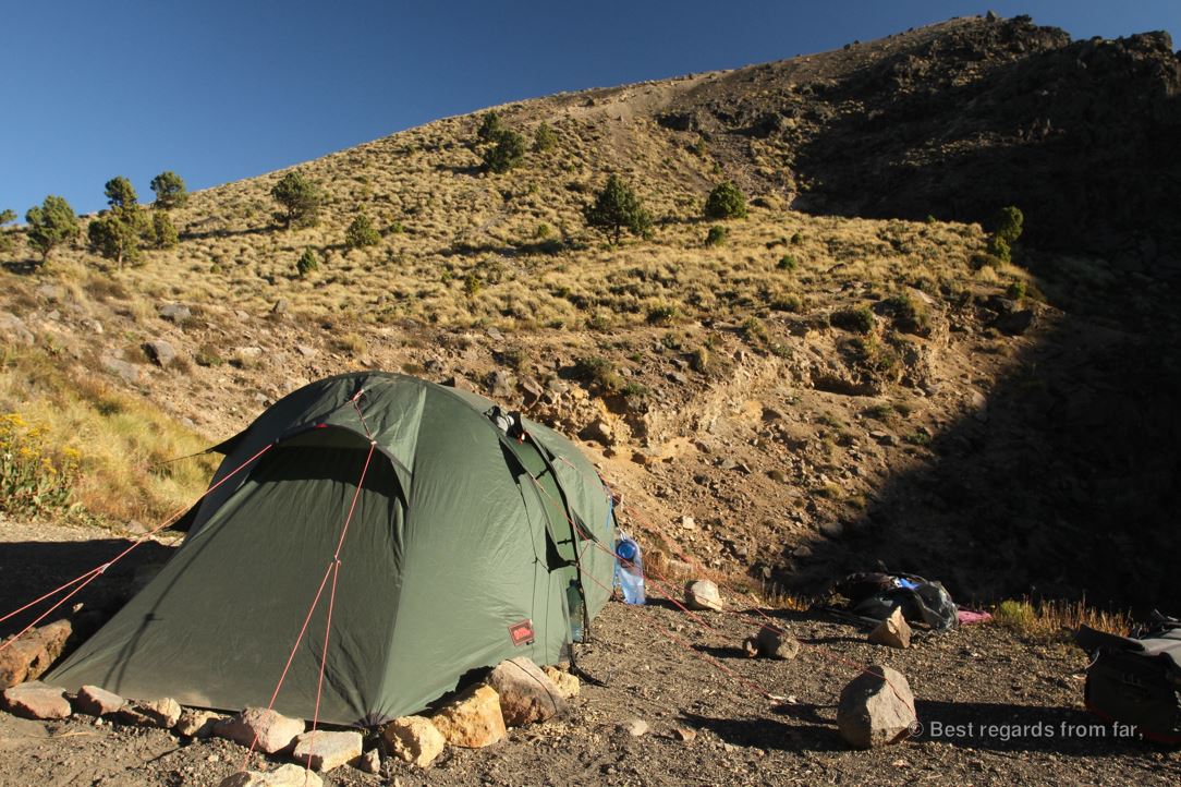
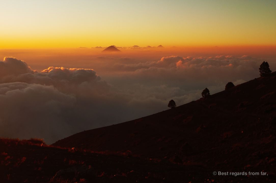
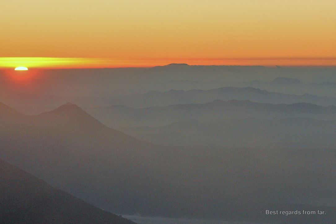
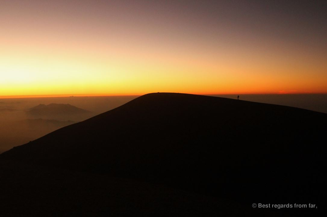
To vainly try to find a protection from the wind, we pitched at the foot of the very last uphill trying to not take off with the tent that felt more like a giant kite. Admiring the fantastic view above the clouds on the volcanoes surrounding lake Atitlan, I kept my sight high so that the moment wouldn’t not be spoiled by the piled up trash. The very last bit of ascent was incredibly tough as the air felt thin because of the altitude making my breathing shallow. Every step up seemed to take me two steps down, as I kept sliding in the volcanic pebbles. Eventually reaching the very top, volcano Fuego revealed itself, at last, linked to us by a 4-kilometer ridge. The shadow of the perfect conic shape of the Acatenango was projected by the sunset light on a layer of clouds next to the imposing Agua volcano. I was so cold in the strong winds that I was wondering if I shouldn’t sleep in the next morning instead of coming back up.

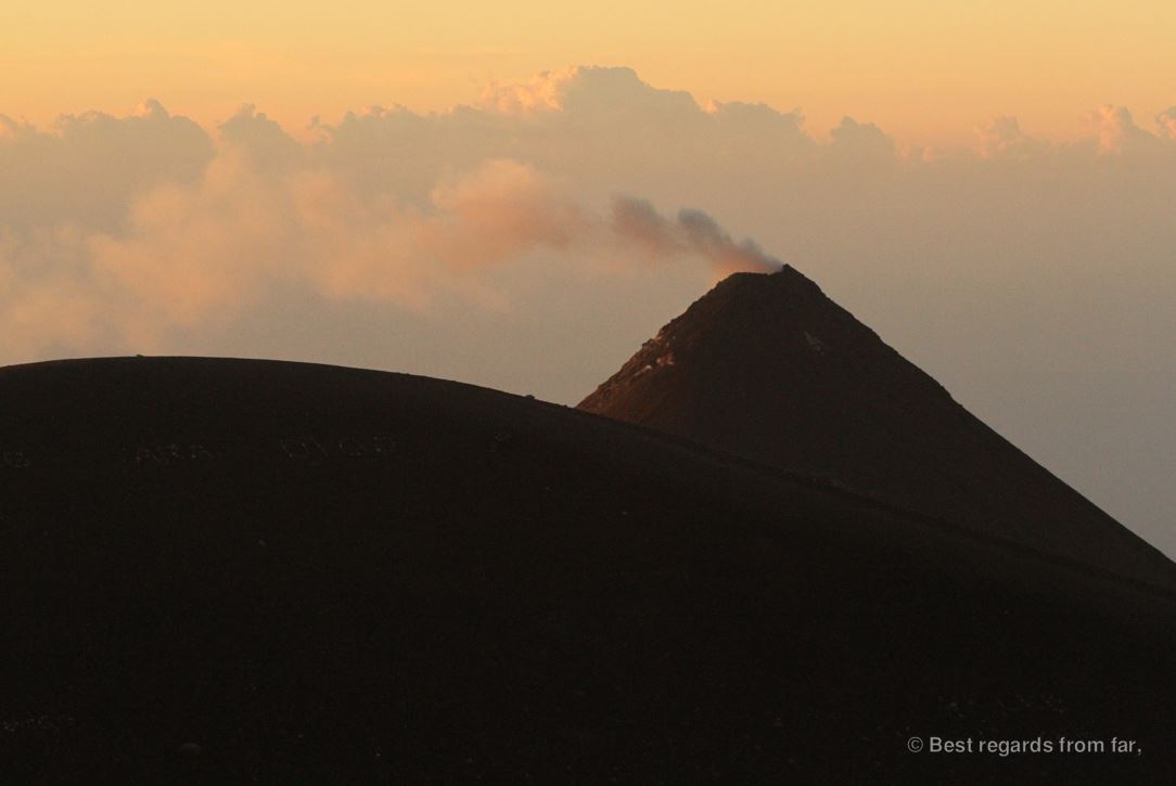
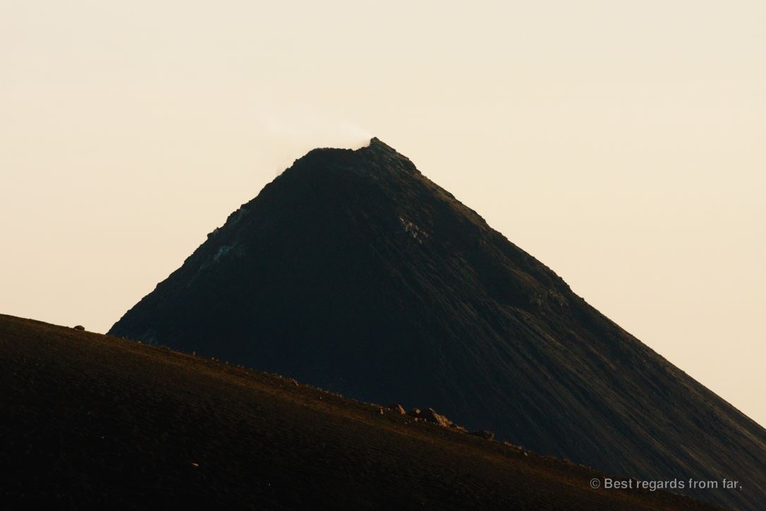
After a cold night with non-stop winds, I got freed by the 4:45AM alarm. I was telling myself that as soon as I would start hiking up, I would warm up fast. And indeed, that worked well until we reached the top. Now, we are waiting for the sun to rise, vainly trying to shelter ourselves from the wind behind a rock. Gloves would have been a good idea, I think as I am struggling to take photos with my numb fingers. Below the stars, the lights of Guatemala City in the background and Antigua at the foot of Agua lit up the night before the sun takes over. The thought of the hot chocolate I will score in our favorite coffee shop of Antigua in a few hours is helpful. Fuego is surprisingly dark and we won’t be rewarded by the sight of red lava spitted out as we have seen from the lake Atitlan a few days ago. Instead, only smoke taints the sky above its steep cone covered with the still hot lava from the previous days.


Skiing down back to the camp with our sturdy hiking boots sliding on pebbles and pushed by the wind, I realize how lucky we are to be the only ones on the mountain. A hearty and warm breakfast later, cooked on an open fire, and we are running down, shedding a layer at every stop we take as the sun rises higher into the sky. On this Saturday morning, we are crossing dozens of people struggling to get up in tourist groups when our escort is stopped by a local man: 6 people who were camping lower were robbed last night, and he has just seen a group of 5 armed men going up…
The Acatenango is the conclusion of our adventures in Guatemala, and it is striking how varied and beautiful the Guatemalan nature is: from the jungles of Péten and the stunning Mayan ruins of Tikal and El Mirador, to the emerald green waters of Semuc Champey, the mountains of the high lands, and the clear waters of lake Atitlan squeezed between volcanoes, the country seems to have it all!
Although, as a westerner, it is sad to see how little respect for nature the local populations have. Beyond cutting down forests, littering is the norm and some of the most beautiful landscapes are piled up with trash, when they could be turned into a bigger source of revenue for local communities. At least, most of these communities have realized that security could generate a more sustainable income than petty theft: this awareness supported by the efforts of the government to promote tourism with initiatives such as the tourist police will hopefully conquer the reputation of Guatemala for being a risky destination.
Travel tips:
- The tourist police is in most touristic sites and can be contacted for assistance on hikes (operacionesproatur@inguat.gob.gt).
- The Acatenango hike can be done over a day or as an overnighter, and is proposed by many tour companies in Antigua. These companies maximize the number of customers and the experience being among a 30-plus-person group would have been completely different.
- The Acatenango Volcano culminates at almost 4,000 meters and it does get down to freezing temperatures: pack warm!
- The hike is demanding and there is no water on the way.
- Check out this interactive map for the specific details to help you plan your trip and more articles and photos (zoom out) about the area!
For more awesome multiday hiking adventures, click on one of these images:
Pin it to get your complete & exclusive Réunion hiking guide later! 

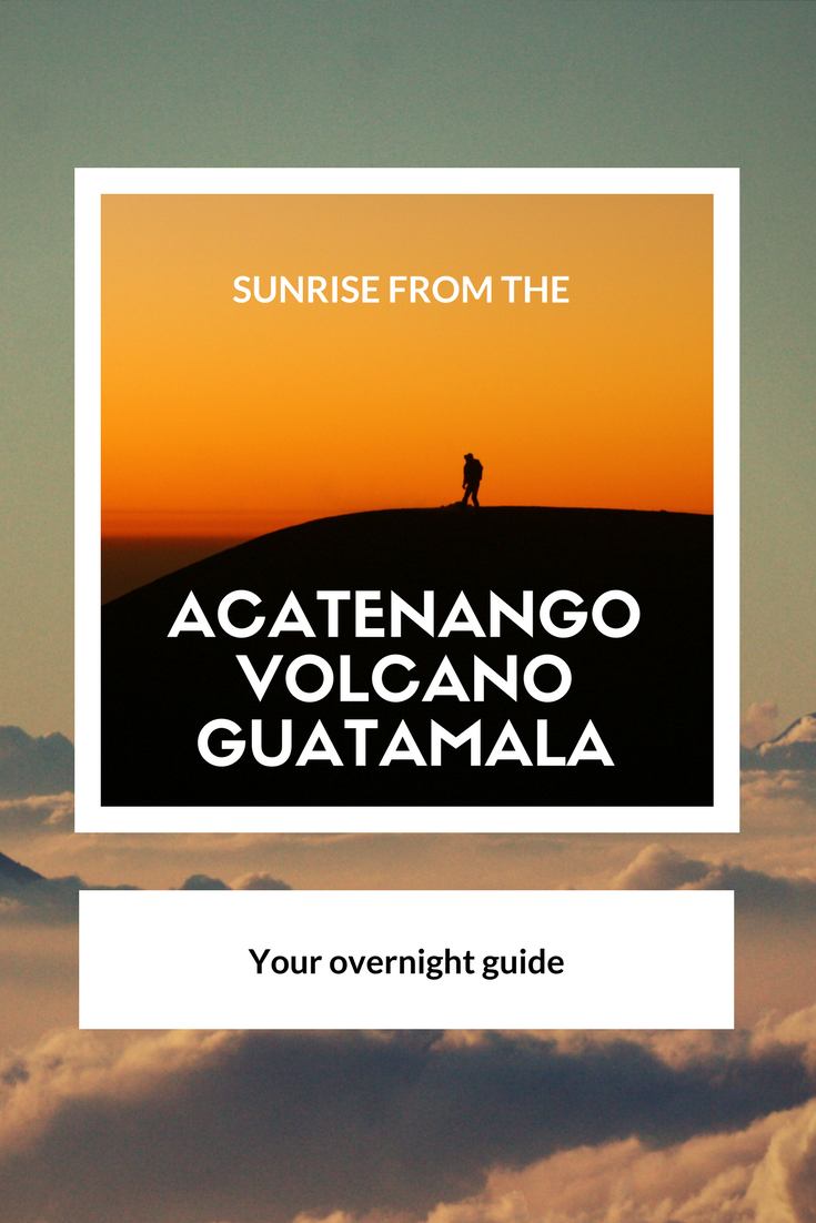
Pin this article for later! 
Pin it for later!

What an awesome experience. Although it sounds dreadful to hike up, having a volcano just to yourself definitely balances the difficulty and cold for sure. I’m heading to Guatemala in a few months so it’s great to know they have a tourist police! I’m not bringing a tent but hopefully will find some diy adventures 😉
Thanks! Yes it was a tough one but so worth it! Really cool that you are heading to Guatemala in a few weeks. For more tips and off the beaten path destinations you might be interested in our interactive map. It’s filled with loads of diy adventures! https://bestregardsfromfar.com/america/central-america/guatemala/interactive-map-guatemala/ have a blast!! 😃